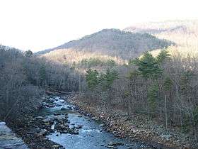
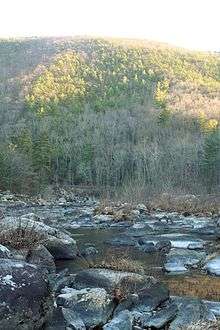
Maury River
| Maury River | |
|---|---|
 Maury River at Goshen Pass | |
| Country | US |
| Basin | |
| Main source |
Confluence of Calfpasture and Little Calfpasture Rivers 1,430 feet (440 m)[1] |
| River mouth |
James River at Glasgow, Virginia 676 feet (206 m)[2] |
| Physical characteristics | |
| Length | 43 miles (69 km)[3] |
The Maury River is a 42.8-mile-long (68.9 km)[3] tributary of the James River in west-central Virginia in the United States. Via the James River, it is part of the watershed of Chesapeake Bay.
The Maury flows for its entire length in Rockbridge County. It is formed near Goshen by the confluence of the Calfpasture and Little Calfpasture rivers, and flows south past Lexington and Buena Vista; between the cities it collects the South River and is paralleled by a 7-mile (11 km) rail trail. The Maury flows into the James River at Glasgow. The Maury River is named in honor of Commodore Matthew Fontaine Maury, and it travels past Lexington's Washington and Lee University and Virginia Military Institute, where Commodore Maury worked in his last years. There is a memorial tablet in stone to the commodore at Goshen Pass.
The United States Board on Geographic Names settled on "Maury River" as the stream's name in 1968. According to the Geographic Names Information System, the stream (or sections thereof) has also been known historically as the "North River" and "Calfpasture River".[2]
History

The Maury River was called "a branch of the North River" before the name was changed within the past few decades. It formed a portion of an all-water route from the Atlantic ports of Virginia to Lexington from the late 18th to the late 19th century, primarily carrying passengers, pig iron, and agricultural products.[4][5] Connected to the James River and Kanawha Canal at Glasgow, a series of canals, locks and dams allowed merchant and passenger James River bateaux to travel the shallow, rocky river. The first canal boat reached Lexington in 1860.
The era of the canal ended fairly quickly (around 1880) along the river, as the Richmond and Alleghany Railroad and later Shenandoah Valley Railroad both built rail lines along major portions of the river which offered faster and easier transportation.[4] Numerous artifacts remain from the canal days including several lock and dam ruins. The lock at Ben Salem Wayside between Buena Vista and Interstate 81 on U.S. Route 60 is well preserved in a park setting. At least two dams from the canal era remain and impound water, Moomaw’s Lock and Dam below the US 60 bridge in Buena Vista, and the Lexington Mills Dam at Jordan’s Point in Lexington which formed the end of canal boat navigation.[5] Several other lock and dam ruins, some almost complete dams, are visible along the river from the Chessie Nature Trail. The Gooseneck Dam downstream of Buena Vista is notable for being featured in a photograph by acclaimed 1950s railroad photographer O. Winston Link.[6]
Floods
The Maury River has a history of destructive floods damaging nearby communities. Particularly notable were floods on Oct 12, 1870, on the death of Robert E. Lee, when the Maury River provided Lee a temporary coffin due to a dock washed away up river (source: Library Virginia Military Institute), and in 1936, 1969, 1985 and 1995.[4] The Flood of ’69 was the result of rainfall from the inland movement of Hurricane Camille. The Flood of ’85 resulted from the convergence of three systems, including Hurricane Juan, which dumped tremendous amounts of rain on western Virginia.[7] The flood of record for the lower Maury River (downstream of the confluence with the South River) including Buena Vista and Glasgow occurred on August 20, 1969, at a stage of 31.23 feet (9.52 m) on the Buena Vista gauge (flooding begins at 17.0 feet (5.2 m) and major flooding at 21.0 feet (6.4 m).[8] The downtowns of Buena Vista and Glasgow were submerged in over 5 feet (1.5 m) of water.[7] The upper Maury River including Lexington saw its flood of record during the Flood of 1985 when the gauging station at Rockbridge Baths recorded a value of 19.19 feet (5.85 m) from flood marks.[9] The difference in flooding results from differing contributions of the South River depending on rainfall in the respective watersheds.
The damage caused by the 1969 flood permanently ended railroad service to Lexington. The tracks of Richmond & Allegany Railroad successor Chesapeake & Ohio Railroad which ran along the bank of the river from its junction with the Norfolk & Western Railroad at Loch Laird (Buena Vista) to Lexington were destroyed along much of the route. Instead of rebuilding the line to Lexington, the C&O Railroad restored the tracks from Loch Laird through Buena Vista to serve several industrial customers. On September 1, 1970, the Interstate Commerce Commission granted the C&O permission to abandon the remainder of the Lexington branch. The C&O (now CSX Transportation) tracks end at Georgia Bonded Fibers below the US 60 bridge over the Maury River. The remaining rail bed was converted to public use as an early example of rails to trails, becoming the Chessie Nature Trail. Due to the creation of the Chessie Nature Trail, this stretch of the Maury River is unusually accessible to pedestrians.[4]
The James C. Olin Flood Control Project was completed in 1997 to reduce the potential for damage from flooding of the Maury River and inland streams in Buena Vista.
Recreation

The Chessie Nature Trail forms a linear park which provides pedestrian access from Buena Vista to Jordan’s Point Park Lexington. The trail winds through scenic mixed hardwood forests and open pastures along the river. Notable parks along the river include Goshen Pass, Jordan’s Point in Lexington, Ben Salem Wayside between Buena Vista and Lexington on US 60, and Glenn Maury Park in Buena Vista. The river is enjoyed by residents and visitors through swimming, fishing, canoeing, kayaking, and floating downstream in inner tubes. The river is largely wide and shallow (typically less than 3 feet (0.91 m) deep with occasional deep holes). The upper portion of the river includes class II, III and IV rapids. Below Jordan’s Point in Lexington, the river is mainly a float trip with Class I and II rapids to the James River at Glasgow.[10] Electric or gasoline-powered boats are rarely if ever used beyond a few areas of slack water upstream of dams.
See also
References
- ↑ U.S. Geological Survey. Goshen quadrangle, Virginia. 1:24,000. 7.5 Minute Series. Washington D.C.: USGS, 1990.
- 1 2 U.S. Geological Survey Geographic Names Information System: Maury River
- 1 2 U.S. Geological Survey. National Hydrography Dataset high-resolution flowline data. The National Map, accessed April 1, 2011
- 1 2 3 4 Field Guide to the Chessie Nature Trail. Rockbrige Area Conservation Council, 1988.
- 1 2 Trout, William E., The Maury River Atlas: Historic Sites on the North (Maury) River, 1992
- ↑ Link, O. Winson. The Last Steam Railroad in America, 1995.
- 1 2 VAEmergency.com > Newsroom & Archives > Virginia Hurricane History
- ↑ Advanced Hydrologic Prediction Service: Blacksburg
- ↑ http://va.water.usgs.gov/annual/2000/sw/02021500.2000.sw.pdf
- ↑ Lexington, Virginia Visitor's Center promoting all of Rockbridge County
- Columbia Gazetteer of North America entry (appears to present pre-1968 information)
- DeLorme (2005). Virginia Atlas & Gazetteer. Yarmouth, Maine: DeLorme. ISBN 0-89933-326-5.
External links
| Wikimedia Commons has media related to Maury River. |
Coordinates: 37°37′26″N 79°26′39″W / 37.62389°N 79.44417°W