Mandrayal
| Mandrayal मंडरायल | |
|---|---|
| city | |
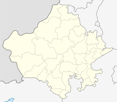
 Mandrayal  Mandrayal Location in Rajasthan, India | |
| Coordinates: 26°18′N 77°14′E / 26.3°N 77.23°ECoordinates: 26°18′N 77°14′E / 26.3°N 77.23°E | |
| Country |
|
| State | Rajasthan |
| District | Karauli |
| Elevation | 262 m (860 ft) |
| Population (2001) | |
| • Total | 23,118 |
| Languages | |
| • Official | Hindi |
| Time zone | IST (UTC+5:30) |
| PIN | 322251 |
| Telephone code | 07464-226... |
| Vehicle registration | RJ |
Mandrayal is a town in the state of Rajasthan, India, with a population of 8590. It is also known as Mandrail or Mandrael. The nearest towns are Sabalgarh, Karauli. The language spoken is Hindi and Khadi BOli. Mandrayal has been declared Panchayat Samiti by Vasundhara Raje in 2014. Population of Mandrayal Tehsil is 74,600.
History
Mandrayal is the main town in the Karauli district. It is most famous for joining the two states of Madhya Pradesh and Rajasthan and also regarding its history. Puranmal, the Raja of Amber fought in the battle called the Battle of Mandrayal in favour of Mughals. This was in the year 1534. Next year, Bahadur Shah of Gujrat besieged the fort of Chittoor, upon which Humayun himself started to fight against him. Rani Karmawati the widow of Rana Sanga was ruling Chittor as regent. She also tried to be friendly with Mughals and sent a Rakhi to Humayun, but Humayun did not arrive in time. If he had arrived in time and helped Karmawati, perhaps it would have been Sisodias as their close allies. However it were Kachwahas who became the first allies of Mughals in Rajputana. Bharmal's policy towards Mughals was merely extension of his brothers policy.
Bharmal's eldest brother Raja Puranmal died at the Battle of Mandrayal in 1534, while helping Humayun to recapture the fort of Bayana. He had a son named Surajmal or Sooja. But he was not recognised as king and his younger brother Raja Bhim Singh asceneded to the throne of Amber. Bhim Singh was succeeded by his son Raja Ratan Singh and Raja Bharmal succeeded him in 1548, CE.
Population
Mandrayal is a large village located in Mandrayal of Karauli district, Rajasthan with total 1588 families residing. The Mandrayal village has population of 8590 of which 4586 are males while 4004 are females as per Population Census 2011.
In Mandrayal village population of children with age 0-6 is 1412 which makes up 16.44% of total population of village. Average Sex Ratio of Mandrayal village is 873 which is lower than Rajasthan state average of 928. Child Sex Ratio for the Mandrayal as per census is 940, higher than Rajasthan average of 888.
Mandrayal village has higher literacy rate compared to Rajasthan. In 2011, literacy rate of Mandrayal village was 70.30% compared to 66.11% of Rajasthan. In Mandrayal Male literacy stands at 82.81% while female literacy rate was 55.75%.
As per constitution of India and Panchyati Raaj Act, Mandrayal village is administrated by Sarpanch (Head of Village) who is elected representative of village.
Festivals
The main religious festivals are Deepawali, Holi, Gangaur, Teej, Gogaji, Makar Sankranti and Janmashtami, as the main religion is Hinduism. Rajasthan's desert festival is celebrated with great zest and zeal. This festival is held once a year during winters. Dressed in brilliantly hued costumes, the people of the desert dance and sing haunting ballads of valor, romance and tragedy. There are fairs with snake charmers, puppeteers, acrobats and folk performers. Camels, of course, play a stellar role in this festival.
Distances of places
- Karauli:40 km
- Hindaun:73 km
- Kota: 270 km
- Gwalior:150 km
- Jaipur: 190 km.
- Sawai Madhopur: 146 km
- Agra: 155 km
- Delhi: 360 km
- Sabalgarh: 35 km
The Madhya Pradesh border formed by the Chambal River is 5 km away from Mandrayal.

- sapotra : 85 km
References
- Precipitation chart
- Map of India
- Mandrayal Fort's Adventure story
- Panchayat Samiti-Mandrayal
- Karauli District
External links
Census: http://www.census2011.co.in/data/village/76863-Mandrayal-rajasthan.html
