Lluxita (Potosí)
This article is about the mountain in the Chayanta Province, Potosí Department, Bolivia. For other uses, see Lluxita.
| Lluxita | |
|---|---|
 Lluxita Location within Bolivia | |
| Highest point | |
| Elevation | 4,100 m (13,500 ft) [1] |
| Coordinates | 18°45′28″S 65°43′18″W / 18.75778°S 65.72167°WCoordinates: 18°45′28″S 65°43′18″W / 18.75778°S 65.72167°W |
| Geography | |
| Location |
Bolivia, Potosí Department |
| Parent range | Andes |
Lluxita (Aymara lluxi shell of a mussel; landslide,[2][3] -ta a suffix, also spelled Llojeta) is a mountain in the Bolivian Andes which reaches a height of approximately 4,100 m (13,500 ft). It is located in the Potosí Department, Chayanta Province, Ocurí Municipality. It lies southeast of the village of Ch'aki Mayu (Chaqui Mayu).[1][4]
References
- 1 2 Bolivia IGM map 1:50,000 Ravelo 6437-I
- ↑ Radio San Gabriel, "Instituto Radiofonico de Promoción Aymara" (IRPA) 1993, Republicado por Instituto de las Lenguas y Literaturas Andinas-Amazónicas (ILLLA-A) 2011, Transcripción del Vocabulario de la Lengua Aymara, P. Ludovico Bertonio 1612 (Spanish-Aymara-Aymara-Spanish dictionary)
- ↑ "Diccionario Quechua - Aymara al español". katari.org. Retrieved April 17, 2016.
- ↑ "Ocurí". INE, Bolivia. Retrieved April 17, 2016.
Capital: Potosí | ||
| Provinces | 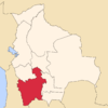 | |
| Municipalities (and seats) |
| |
This article is issued from Wikipedia - version of the 4/17/2016. The text is available under the Creative Commons Attribution/Share Alike but additional terms may apply for the media files.