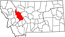
List of cemeteries in Lewis and Clark County, Montana
This list is incomplete; you can help by expanding it.
There are at least 25 named cemeteries in Lewis and Clark County, Montana. Some cemeteries are considered historical by the U.S. Board on Geographic Names: Historical Features – Features that no longer exist on the landscape or no longer serve the original purpose.[1]
- Augusta Cemetery, 47°29′46″N 112°24′17″W / 47.49611°N 112.40472°W, el. 4,124 feet (1,257 m) [2]
- Benton Avenue Cemetery, 46°36′18″N 112°02′33″W / 46.60500°N 112.04250°W, el. 3,966 feet (1,209 m) [3]
- Calvary Cemetery, 46°35′59″N 112°04′20″W / 46.59972°N 112.07222°W, el. 4,153 feet (1,266 m) [4]
- Carterville/Wolf Creek Cemetery, 47°00′22″N 112°04′09″W / 47.00611°N 112.06917°W, el. 3,563 feet (1,086 m) [5]
- Cemetery Island/Canyon Ferry Cemetery, 46°38′05″N 111°42′21″W / 46.63472°N 111.70583°W, el. 3,802 feet (1,159 m) [6]
- Craig Cemetery, 47°04′40″N 111°58′08″W / 47.07778°N 111.96889°W, el. 3,570 feet (1,090 m) [7]
- Dearborn Cemetery, 47°09′52″N 112°13′52″W / 47.16444°N 112.23111°W, el. 4,272 feet (1,302 m) [8]
- East Helena Cemetery, 46°35′40″N 111°54′55″W / 46.59444°N 111.91528°W, el. 3,871 feet (1,180 m) [9]
- Forestvale Cemetery, 46°39′23″N 112°02′13″W / 46.65639°N 112.03694°W, el. 3,753 feet (1,144 m) [10]
- Hardgrove Cemetery, 46°39′13″N 111°53′39″W / 46.65361°N 111.89417°W, el. 3,770 feet (1,150 m) [11]
- Home of Peace Cemetery (Helena, Montana), 46°36′55″N 112°03′03″W / 46.61528°N 112.05083°W, el. 3,875 feet (1,181 m) [12]
- Independent Order of Odd Fellows Cemetery, 46°39′15″N 112°01′48″W / 46.65417°N 112.03000°W, el. 3,753 feet (1,144 m) [13]
- Lewis and Clark County Cemetery, 46°39′23″N 112°01′51″W / 46.65639°N 112.03083°W, el. 3,750 feet (1,140 m) [14]
- Lewis and Clark County Poor Farm Cemetery, 46°37′25″N 112°02′18″W / 46.62361°N 112.03833°W, el. 3,822 feet (1,165 m) [15]
- Lincoln Gulch Cemetery, 46°58′57″N 112°46′11″W / 46.98250°N 112.76972°W, el. 4,685 feet (1,428 m) [16]
- Marysville Cemetery, 46°45′24″N 112°17′28″W / 46.75667°N 112.29111°W, el. 5,541 feet (1,689 m) [17]
- Montana State Veterans Cemetery, 46°36′30″N 112°05′06″W / 46.60833°N 112.08500°W, el. 3,944 feet (1,202 m) [18]
- Moore Graves, 47°05′49″N 112°03′11″W / 47.09694°N 112.05306°W, el. 3,924 feet (1,196 m) [19]
- Resurrection Cemetery, 46°37′46″N 112°01′05″W / 46.62944°N 112.01806°W, el. 3,789 feet (1,155 m) [20]
- Saint Anns Cemetery, 46°35′12″N 111°54′08″W / 46.58667°N 111.90222°W, el. 3,898 feet (1,188 m) [21]
- Serbian Cemetery, 46°35′12″N 111°54′07″W / 46.58667°N 111.90194°W, el. 3,898 feet (1,188 m) [22]
- Silver City Cemetery, 46°44′10″N 112°10′51″W / 46.73611°N 112.18083°W, el. 4,340 feet (1,320 m) [23]
- Sunset Memorial Cemetery, 46°41′27″N 112°01′18″W / 46.69083°N 112.02167°W, el. 3,734 feet (1,138 m) [24]
- Tuck Cemetery, 46°59′42″N 112°40′21″W / 46.99500°N 112.67250°W, el. 4,803 feet (1,464 m) [25]
- York Cemetery, 46°43′22″N 111°45′13″W / 46.72278°N 111.75361°W, el. 4,124 feet (1,257 m) [26]
See also
Notes
- ↑ "Domestic Names - State and Topical Gazetteer Download Files". Retrieved 2010-06-30.
- ↑ "Augusta Cemetery". Geographic Names Information System. United States Geological Survey.
- ↑ "Benton Avenue Cemetery". Geographic Names Information System. United States Geological Survey.
- ↑ "Calvary Cemetery". Geographic Names Information System. United States Geological Survey.
- ↑ "Carterville/Wolf Creek Cemetery". Geographic Names Information System. United States Geological Survey.
- ↑ "Cemetery Island/Canyon Ferry Cemetery". Geographic Names Information System. United States Geological Survey.
- ↑ "Craig Cemetery". Geographic Names Information System. United States Geological Survey.
- ↑ "Dearborn Cemetery". Geographic Names Information System. United States Geological Survey.
- ↑ "East Helena Cemetery". Geographic Names Information System. United States Geological Survey.
- ↑ "Forest Vale Cemetery". Geographic Names Information System. United States Geological Survey.
- ↑ "Hardgrove Cemetery". Geographic Names Information System. United States Geological Survey.
- ↑ "Home of Peace Cemetery". Geographic Names Information System. United States Geological Survey.
- ↑ "Independent Order of Odd Fellows Cemetery". Geographic Names Information System. United States Geological Survey.
- ↑ "Lewis and Clark County Cemetery". Geographic Names Information System. United States Geological Survey.
- ↑ "Lewis and Clark County Poor Farm Cemetery". Geographic Names Information System. United States Geological Survey.
- ↑ "Lincoln Gulch Cemetery". Geographic Names Information System. United States Geological Survey.
- ↑ "Marysville Cemetery". Geographic Names Information System. United States Geological Survey.
- ↑ "Montana State Veterans Cemetery". Geographic Names Information System. United States Geological Survey.
- ↑ "Moore Graves". Geographic Names Information System. United States Geological Survey.
- ↑ "Resurrection Cemetery". Geographic Names Information System. United States Geological Survey.
- ↑ "Saint Anns Cemetery". Geographic Names Information System. United States Geological Survey.
- ↑ "Serbian Cemetery". Geographic Names Information System. United States Geological Survey.
- ↑ "Silver City Cemetery". Geographic Names Information System. United States Geological Survey.
- ↑ "Sunset Memorial Cemetery". Geographic Names Information System. United States Geological Survey.
- ↑ "Tuck Cemetery". Geographic Names Information System. United States Geological Survey.
- ↑ "York Cemetery". Geographic Names Information System. United States Geological Survey.
This article is issued from Wikipedia - version of the 9/12/2015. The text is available under the Creative Commons Attribution/Share Alike but additional terms may apply for the media files.
