Larrouy Island
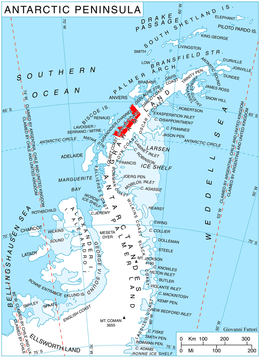
Location of Graham Coast on the Antarctic Peninsula.
Larrouy Island (65°52′S 65°15′W / 65.867°S 65.250°WCoordinates: 65°52′S 65°15′W / 65.867°S 65.250°W) is an island 5 nautical miles (9 km) long and 2 nautical miles (4 km) wide which rises to 745 metres (2,440 ft), (the Peak Pilot[1]) lying in Grandidier Channel off the northwest coast of Velingrad Peninsula 4 nautical miles (7 km) north of Ferin Head, Antarctica. It was discovered by the French Antarctic Expedition, 1903–05, under Jean-Baptiste Charcot, who named it for Paul Augustin Jean Larrouy, at that time a French Minister Plenipotentiary.[2]
See also
References
- ↑ Gildea, Damien (2015). Mountaineering in Antarctica: complete guide: Travel guide. Nevicata.
- ↑ "Larrouy Island". Geographic Names Information System. United States Geological Survey. Retrieved 2013-05-31.
![]() This article incorporates public domain material from the United States Geological Survey document "Larrouy Island" (content from the Geographic Names Information System).
This article incorporates public domain material from the United States Geological Survey document "Larrouy Island" (content from the Geographic Names Information System).
This article is issued from Wikipedia - version of the 11/21/2015. The text is available under the Creative Commons Attribution/Share Alike but additional terms may apply for the media files.