Lüschgrat
| Lüschgrat | |
|---|---|
 | |
| Highest point | |
| Elevation | 2,178 m (7,146 ft) |
| Prominence | 332 m (1,089 ft) [1] |
| Coordinates | 46°42′6″N 9°20′44″E / 46.70167°N 9.34556°ECoordinates: 46°42′6″N 9°20′44″E / 46.70167°N 9.34556°E |
| Geography | |
 Lüschgrat Location in Switzerland | |
| Location | Graubünden, Switzerland |
| Parent range | Lepontine Alps |
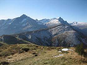
The Lüschgrat is a mountain of the Swiss Lepontine Alps, located between Safien and Thusis in the canton of Graubünden. With a height of 2,178 metres above sea level, it is the culminating point of the range north of the Glas Pass.
References
External links
This article is issued from Wikipedia - version of the 9/4/2016. The text is available under the Creative Commons Attribution/Share Alike but additional terms may apply for the media files.