Kuntur Qaqa (Chayanta)
This article is about the mountain in the Chayanta Province, Potosí Department, Bolivia. For other uses, see Kuntur Qaqa.
| Kuntur Qaqa | |
|---|---|
 Kuntur Qaqa Location within Bolivia | |
| Highest point | |
| Elevation | 3,436 m (11,273 ft) [1] |
| Coordinates | 18°49′30″S 65°28′37″W / 18.82500°S 65.47694°WCoordinates: 18°49′30″S 65°28′37″W / 18.82500°S 65.47694°W |
| Geography | |
| Location |
Bolivia, Potosí Department |
| Parent range | Andes |
Kuntur Qaqa (Quechua kuntur condor, qaqa rock,[2] "condor rock", also spelled Condor Khakha) is a 3,436-metre-high (11,273 ft) mountain in the Bolivian Andes. It is located in the Potosí Department, Chayanta Province, Ravelo Municipality, southeast of Ravelo.[1][3]
References
Capital: Potosí | ||
| Provinces | 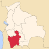 | |
| Municipalities (and seats) |
| |
This article is issued from Wikipedia - version of the 5/5/2016. The text is available under the Creative Commons Attribution/Share Alike but additional terms may apply for the media files.