Kotliarka
| Kotliarka Котлярка | |
|---|---|
| Village | |
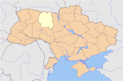 Kotliarka Kotliarka within Ukraine. | |
| Coordinates: 50°01′40″N 29°19′55″E / 50.02778°N 29.33194°ECoordinates: 50°01′40″N 29°19′55″E / 50.02778°N 29.33194°E | |
| Country Region Municipality |
|
| First mentioned | 1700s |
| Government | |
| • Type | Village Council |
| • Body | 12 |
| • Chairman |
Nelia Nazaruk Address: 5a Gagarin St., Phone: 04137-71435, Email: kotlyarka.s.u@ukr.net[1] |
| Area | |
| • Land | 2,37 km2 (92 sq mi) |
| Elevation | 210 m (690 ft) |
| Population | |
| • Total | 429 |
| • Density | 181/km2 (470/sq mi) |
| Time zone | EET (UTC+2) |
| • Summer (DST) | EEST (UTC+3) |
| Postal code | 13523 |
| Area code(s) | +380 4137 |
Kotliarka (Ukrainian: Котлярка, Ukrainian pronunciation: [kot'lʲɑrkɐ]) is a village in Ukraine, located in the Popilnia Raion of the Zhytomyr Oblast (province).[2] The village belongs to an eponymous village council - the Kotliarka village council.
The name of the village might be derived from the Ukrainian word Kotliar (Котляр), which means boilermaker.
In 2014, according to the Popilnia Raion Council, the village population was 429 people (204 men and 225 women) of 261 households.
There are a kindergarten, school, social club, library, medical assistant's, post office, 2 retail shops, cafe, place of worship in the village.[3]
Geography
The village is situated in the west of the Dnieper Upland and the historical region Right-bank Ukraine.
The village council area borders the Andrushivka Raion in the west and the next village councils of the Popilna Raion: Lypky in the east, Khodorkiv in the north, Sokilcha in the south-west, Velyki Lisivtsi in the south and Myroliubivka in the south-east.
The very small river Kryvenka (Ukrainian: Кривенька, English: Curved) flows through the village and falls into the Unava River, which flows into the Irpin River of the Dnieper basin by its turn. There is a pond on the river in the village, that is called the Kryvenka Reservoir.[4]
Two not too big forests are in the south of the village towards Markova Volytsa and Liubymivka villages. They were parts of a large forest[5] in the Popilnia Raion, that forest was significantly cut down because of the intensive potash production in XIV - XIX centuries there, which needed a lot of wood.[6][7][8]
By roads, the village is located:
- 14 km to the nearest railway station Yaropovychi.
- 15 km to the district centre Popilnia.
- 58 km to the region centre Zhytomyr.
- 138 km to the capital of Ukraine Kiev.
- 153 km to Boryspil International Airport.
History
Next to the village, Serpent's Walls[9] and ancient kurgans[10] were found.
During the Political repression in the Soviet Union, especially in the Great Purge, a lot of villagers were being executed or deported. Ethnic Ukrainian families: Babych, Blinkevych, Ivaniuk, Kyianchuk, Mozharivsky, Savchuk, Syvkovych, Tkach, Vazytsky, Vitkivsky and Polish families: Baladinski, Czopiwski, Dimovicz, Drenczik, Kaszperski, Mozarowski, Rowinski, Rudnicki, Smogorzewski, Werpachowski, Wilczinski, Zawadski were subjected to repression.[11]
References
- ↑ Leaders of the Kotliarka village council // Popilnia Raion council
Ukrainian: Керівництво Котлярської сільської ради - ↑ Kotliarka // The History of Cities and Villages of the Ukrainian SSR
Ukrainian: Село Котлярка, Попільнянський район - ↑ Socioeconomics of Kotliarka village // Popilna Raion Council
Ukrainian: Соціально-економічна характеристика села Котлярка - ↑ Kotliarka // mistaUA
Ukrainian: Котлярка, Попільнянський район, Житомирська область, Україна // mistaUA - ↑ Military Topographic Map of the Russian Empire 1846-1863
Russian: Военно-топографическая карта Российской Империи 1846-1863 гг. - ↑ Calaméo - H. Shvydko // History of Ukraine, XIV - XVII
Ukrainian: Г. К. Швидько. Історія України. 8 клас - ↑ Rural crafts and trades in Ukraine, XVI - XVII
Ukrainian: Сільські ремесла і промисли України у другій половині XVI — першій половині XVII ст. - ↑ History // Popilnya village council
Ukrainian: Історія // Попільнянська селищна рада - ↑ Cultural heritage Protection // Popilnya Raion Central Library
Ukrainian: Охорона культурної спадщини - Попільнянська центральна районна бібліотека - ↑ O. M. Ivashchenko // Historical and Cultural Monuments and Memorials in Zhytomyr Region (Popilnya Raion), Issue 9 // Zhytomyr, 2007 // p. 174-177. ISBN 978-966-655-267-2
Ukrainian: Іващенко О. М. Пам'ятки і пам'ятні місця історії та культури на Житомирщині (Попільнянський район). Випуск 9. — Житомир, 2007. — с. 174—177. ISBN 978-966-655-267-2 - ↑ Zhytomyr Oblast // Ukrainian Institute of National Remembrance
Ukrainian: Житомирська область // © Головна редакційна колегія науково-документальної серії книг «Реабілітовані історією», Український інститут національної пам'яті