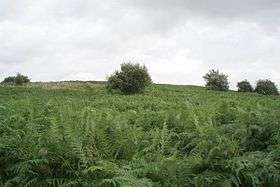
Knowle Hill
| Knowle Hill | |
|---|---|
 | |
| Highest point | |
| Elevation | 112 m (367 ft) |
| Coordinates | 51°20′59″N 2°35′54″W / 51.34972°N 2.59833°WCoordinates: 51°20′59″N 2°35′54″W / 51.34972°N 2.59833°W |
| Geography | |
 Knowle Hill Chew Valley, Somerset, England | |
| OS grid | ST584613 |
Knowle Hill (grid reference ST583613) is a hill in the Chew Valley, Somerset, England situated between the village of Chew Magna and Chew Valley Lake.
The south side of the summit of Knowle Hill is home to the grass Wood Small-reed (Calamagrostis epigejos). The population of this plant forms a circular patch some 20 metres wide, which is visible from Bishop Sutton 1.2km south across Hollow Brook. It has been suggested that this patch is a single clone which has spread by means of underground rhizomes, and may be 200 years old.[1]
The hill is declared open access land under the Countryside and Rights of Way Act 2000[2] and is on the route of the Chew Valley Three Peaks walk,[3] and the Two Rivers Way.[4]
References
- ↑ Janes, Rowland (ed) (1987). The Natural History of the Chew Valley. Biografix. ISBN 978-0-9545125-2-1., p.63
- ↑ Access Land: Knowle Hill Bath and North East Somerset council website, retrieved 24 July 2010
- ↑ Chew Valley Three Peaks walk, retrieved 24 July 2010
- ↑ "Two Rivers Way". Long Distance Walkers Association. Retrieved 25 July 2010.
This article is issued from Wikipedia - version of the 9/15/2013. The text is available under the Creative Commons Attribution/Share Alike but additional terms may apply for the media files.