Kiwuri (Abaroa)
This article is about the mountain in the Eduardo Abaroa Province, Oruro Department, Bolivia. For other uses, see Kiwuri.
| Kiwuri | |
|---|---|
 Kiwuri Location in Bolivia | |
| Highest point | |
| Elevation | 4,540 m (14,900 ft) [1] |
| Coordinates | 18°51′39″S 66°32′43″W / 18.86083°S 66.54528°WCoordinates: 18°51′39″S 66°32′43″W / 18.86083°S 66.54528°W |
| Geography | |
| Location | Bolivia, Oruro Department, Eduardo Abaroa Province |
| Parent range | Andes |
Kiwuri (Aymara kiwu canine tooth or tusk,[2] -ri a suffix, also spelled Quiburi) is a mountain in the Andes of Bolivia which reaches a height of approximately 4,540 m (14,900 ft). It is located in the Oruro Department, Eduardo Abaroa Province, Challapata Municipality. The Waylla Q'awa which originates northeast of the mountain flows along its northern slope.[1][3]
References
- 1 2 BIGM map 1:50,000 6237-II Cerro Azanaques
- ↑ "Diccionario Bilingüe, Castellano - Aymara, Para: Tercera Edición". Félix Layme Pairumani. Retrieved April 20, 2016.
- ↑ "Challapata". ine.gob.bo. Retrieved April 20, 2016.
Capital: Oruro | ||
| Provinces | 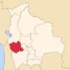 | |
| Municipalities (and seats) |
| |
This article is issued from Wikipedia - version of the 4/28/2016. The text is available under the Creative Commons Attribution/Share Alike but additional terms may apply for the media files.