Kingston, Ontario
| Kingston (Cataraqui) | |
|---|---|
| City (single-tier) | |
| City of Kingston | |
|
Kingston City Skyline from Fort Henry Hill | |
| Nickname(s): Limestone City | |
|
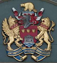
Motto: Antiquitate Civilitate Humanitate (Latin) ("A Civil And Creative Community With A Proud Past") | |
 Kingston | |
| Coordinates: 44°14′N 76°30′W / 44.233°N 76.500°WCoordinates: 44°14′N 76°30′W / 44.233°N 76.500°W | |
| Country | Canada |
| Province | Ontario |
| County | Frontenac |
| Established | 1673 (as Fort Cataraqui; later renamed Fort Frontenac) |
| Incorporated | 1838 (as town); 1846 (as city) |
| Amalgamated | 1998 (with Kingston and Pittsburgh Twps) |
| Government | |
| • City Mayor | Bryan Paterson[1] |
| • Governing Body | Kingston City Council |
| • MP (Federal) | Scott Reid (CPC) |
| • MPP (Provincial) | Sophie Kiwala (OLP) |
| Area | |
| • City (single-tier) | 450.39 km2 (173.90 sq mi) |
| • Metro | 1,906.82 km2 (736.23 sq mi) |
| Elevation | 93 [2] m (230–360 ft) |
| Population (2011) | |
| • City (single-tier) | 123,363 |
| • Density | 273.4/km2 (708/sq mi) |
| • Metro | 159,561 |
| • Metro density | 82.3/km2 (213/sq mi) |
| source: Statistics Canada | |
| Time zone | Eastern (EST) (UTC−5) |
| • Summer (DST) | Eastern (EDT) (UTC−4) |
| Postal code span | K7K through K7P |
| Area code(s) | 613 343 |
| Website | www.cityofkingston.ca |

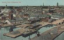
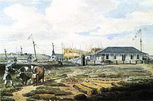

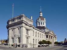
Kingston is a city in Eastern Ontario, Canada. It is located on the eastern end of Lake Ontario, at the beginning of the St. Lawrence River and at the mouth of the Cataraqui River (south end of the Rideau Canal). The city is located midway between Toronto and Montreal. The Thousand Islands tourist region is nearby to the east. Kingston is nicknamed the "Limestone City" because of the many heritage buildings constructed using local limestone.
Growing European exploration in the 17th century and the desire for the Europeans to establish a presence close to local Native occupants to control trade led to the founding of a French trading post and military fort at a site known as "Cataraqui" in 1673. This outpost, called Fort Cataraqui or Fort Frontenac, became a focus for settlement. After the British conquered New France, the village was renamed Kingston.
Kingston was named the first capital of the Province of Canada on February 10, 1841.[3] While its time as a political centre was short, Kingston has remained an important military installation. Kingston was the county seat of Frontenac County until 1998. Kingston is now a separated municipality from the County of Frontenac.
Naming history and etymology
A number of origins of "Cataraqui", Kingston's original name, have been postulated. One is that it is derived from the Iroquois word that means "the place where one hides".[4] The name may also be derivations of Native words that mean "impregnable", "muddy river", "place of retreat", "clay bank rising out of the water" or "where the rivers and lake meet".[5][6][7]
Cataraqui today refers to an area around the intersection of Princess Street and Sydenham Road, where a village which later took that name was located. Cataraqui is also the name of a municipal electoral district.
Cataraqui was referred to as "the King's Town" or "King's Town" by 1787 in honour of King George III. The name was shortened to "Kingston" in 1788.[8][9]
History
Early aboriginal habitation
Archaeological evidence suggests that people lived in the Kingston region as early as the Archaic Period (about 9,000–3,000 years ago).[10][11] Evidence of Late Woodland Period (about 1000–500 AD) early Iroquois occupation also exists.[12]
The first more permanent encampments by aboriginal people in the Kingston area began about 500 AD.[13] The group that first occupied the area before the arrival of the French was probably the Wyandot people (Hurons), who were later displaced by Iroquoian groups.[13]
At the time the French arrived in the Kingston area, Five Nations Iroquois (Haudenosaunee) had settled along the north shore of Lake Ontario.[14] Although the area around the south end of the Cataraqui River was often visited by Iroquois and other groups, Iroquois settlement at this location only began after the French established their outpost.[15] By 1700, the north shore Iroquois had moved south, and the area once occupied by the Iroquois (which includes Kingston) became occupied by the Mississaugas who had moved south from the Lake Huron and Lake Simcoe regions.[16]
French settlement
European commercial and military influence and activities centered on the fur trade developed and increased in North America in the 17th century. Fur trappers and traders were spreading out from their centres of operation in New France. French explorer Samuel de Champlain visited the Kingston area in 1615.
To establish a presence on Lake Ontario for the purpose of controlling the fur trade with local Natives, Louis de Buade de Frontenac, Governor of New France established Fort Cataraqui, later to be called Fort Frontenac, at a location known as Cataraqui (generally pronounced "kah-tah-ROCK-way") in 1673. The fort served as a trading post and military base, and attracted Native and European settlement until it was captured and destroyed by the British in the Battle of Fort Frontenac during the Seven Years' War in 1758.
Loyalist settlement
Settlement resumed in the early 1780s when the area soon to be called Kingston became a receiving centre for Loyalist refugees who fled north because of the American Revolutionary War.
In 1783, Frederick Haldimand, governor of the Province of Quebec directed Major Samuel Holland, Surveyor General, to examine the old French fort (Fort Frontenac) for its potential use as a military post and the surrounding area for its suitability for the settlement by Loyalists. The survey would also determine whether Cataraqui was suitable as a navy base since nearby Carleton Island on which a British navy base was located had been ceded to the Americans after the war. Holland's positive report mentioned that "every part surpassed the favorable idea I had formed of it", that it had "advantageous Situations" and that "the harbour is in every respect Good and most conveniently situated to command Lake Ontario".[17] Major John Ross, commanding officer of the garrison at Oswego, was put in command of preparing the new post and played a significant role in establishing the Cataraqui settlement. The site of Fort Frontenac was partially restored, a military garrison and dockyard were established, the area was surveyed in detail, and grist and saw mills were built.
Several Loyalists who had sought refuge on Carleton Island during the Revolutionary War and operated businesses on the island arrived at Cataraqui and resumed their businesses in the vicinity of the fort. Notable Loyalists who settled in the new community include Molly Brant (the sister of Six Nations leader Joseph Brant); businessman and political figure Richard Cartwright; a group of Loyalists led by Michael Grass who arrived in 1784, having sailed from New York and up the St. Lawrence River; John Stuart, a clergyman, missionary and educator who arrived in 1785; and militia captain Johan Jost Herkimer.
To facilitate settlement, the British Crown entered into an agreement with the Mississaugas in October 1783 to purchase land. This agreement, known as the Crawford Purchase, enabled settlement for much of the eastern section of the north shore of Lake Ontario.[18]
18th–19th centuries
During the War of 1812, Kingston was the base for the Lake Ontario division of the Great Lakes British naval fleet, which engaged in a vigorous arms race with the American fleet based at Sackets Harbor, New York for control of Lake Ontario. The Provincial Marine quickly placed ships into service and troops were brought in. Fortifications and other defensive structures were built.
In the 1840s, the Upper Canadian government built Fort Henry and a series of distinctive Martello towers to guard the entrance to the Rideau Canal, the shipyard on Point Frederick, and the harbour. All still exist, and Fort Henry is a popular tourist attraction. The nearby village of Barriefield, overlooking the Cataraqui River was settled in the 1830s, and is now a well-preserved historical neighbourhood.
Kingston's location at the Rideau Canal entrance to Lake Ontario made it the primary military and economic centre of Upper Canada after canal construction was completed in 1832. Incorporated as a town in 1838, the first mayor of Kingston was Thomas Kirkpatrick. Kingston had the largest population of any centre in Upper Canada until the 1840s. Kingston was incorporated as a city in 1846.
Kingston became an important port as businesses relating to transshipment, or forwarding, grew. Since Kingston was located at the junction of the St. Lawrence River and Lake Ontario, commodities shipped along the lake from the west such as wheat, flour, meat, and potash were unloaded and stored at Kingston to await transfer to vessels that could navigate the risky St. Lawrence. With the completion of the Rideau Canal, cargoes could be transported in a safer fashion since the St.Lawrence River route could be bypassed. The canal was a popular route for transporting lumber.[19]
Queen's University was founded in 1841, while the Royal Military College of Canada (RMC) was founded in 1876. Kingston Penitentiary, Canada's first large federal penitentiary, was established in 1835 and operated until 2013. Several more prisons were established in the greater Kingston area, including the federal Prison for Women (closed in the 1990s), Millhaven Penitentiary, Collins Bay, Frontenac, and Joyceville Institutions.
Governor General Lord Sydenham chose Kingston as the first capital of the united Canadas and it served in that role from 1841 to 1844. The first meeting of the Parliament of the United Canadas on June 13, 1841, was held on the site of what is now Kingston General Hospital. The city was considered too small and lacking in amenities, however, and its location near the border made it vulnerable to American attack. Consequently, the capital was moved to Montreal in 1844, and it alternated between Quebec City and Toronto from 1849 until Ottawa was selected as the permanent capital by Queen Victoria. Subsequently, Kingston's growth slowed considerably and its national importance declined.
The Kingston General Hospital site also held the remains of 1,400 Irish immigrants who had died in Kingston in fever sheds along the waterfront, during the typhus epidemic of 1847, while fleeing the Great Famine. Their remains were re-interred at the city's St. Mary's Cemetery in 1966.[20] In 1995, the hospital was designated a National Historic Site of Canada, because it is "the oldest public hospital in Canada still in operation with most of its buildings intact and thus effectively illustrates the evolution of health care in Canada in the 19th and 20th centuries."[21]
Kingston was the home of Canada's first Prime Minister, Sir John A. Macdonald. One of his residences in Kingston, Bellevue House, is now a popular National Historic Site of Canada open to the public and depicting the house as it would have been in the 1840s when he lived there.
19th–21st centuries
The Canadian Locomotive Company was at one time the largest locomotive works in the British Empire and the Davis Tannery was at one time the largest tannery in the British Empire. The tannery operated for a century and was closed in 1973.[22] Other manufacturing companies included the Marine Railway Company, which built steamboats; the Victoria Iron Works, which produced iron in bars from scrap; several breweries; a distillery; and two soap and candle manufacturers.[23] Most heavy industry has left the city and their former sites are gradually being rehabilitated and redeveloped.
Kingston's military role expanded as Canadian Forces Base Kingston began to be developed during World War I.
Kingston grew moderately through the 20th century through a series of annexations of lands in adjacent Kingston Township, including a 1952 annexation of some 5,500 acres (22 km2) which encompassed areas west to the Little Cataraqui Creek (including the village of Portsmouth), where a number of large residential subdivisions were built in the late 1950s and early '60s.
Kingston's economy gradually evolved from an industrial to an institutional base after World War II. Queen's University grew from about 2,000 students in the 1940s to its present size of over 20,000 students, more than 90 per cent of which are from outside the Kingston area. The Kingston campus of St. Lawrence College was established in 1967, and the college currently has over 4,000 students. Kingston is a regional health care centre, anchored by Kingston General Hospital and the medical school at Queen's. The city's economy is also dominated by post-secondary education, military institutions, and prison installations.
Municipal governance had been a topic of discussion since the mid-1970s due to financial imbalance between the city and the surrounding townships, which now had large residential areas and a population approaching that of the city proper. On January 1, 1998, the City was amalgamated with Kingston Township and Pittsburgh Township to form the new City of Kingston. The city's boundaries now encompass large rural areas north of Highway 401 and east of the Cataraqui River.
The Great Fire of 1840
In the early hours of April 18, 1840, a dock fire, fanned by high winds, spread to a warehouse containing between 70 and 100 kegs of gunpowder. The resulting explosion spread the fire throughout the city's downtown area, destroying a large number of buildings, including the old city hall. To prevent similar incidents from occurring in future, the city began building with limestone or brick. This rebuilding phase was referred to as "the Limestone Revolution" and earned the city the nickname "The Limestone City".[24][25][26]
Military history
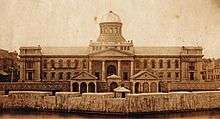
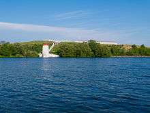
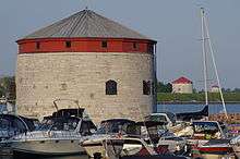
Kingston, being strategically located at the head of the St. Lawrence River and at the mouth of the Cataraqui River near the border with the United States, has been a site of military importance since Fort Frontenac was built in 1673. The French, and later, the British established military garrisons. The War of 1812 led to the bolstering of military troops, the servicing of ships, and the building of new fortifications to defend the town and the Naval Dockyard. Forts were constructed on Point Henry and Point Frederick. A picket wall, or stockade, incorporating five blockhouses was built to the west of the town, and batteries were constructed.[27][28]
Several defensive fortifications were constructed in the late 1840s because of tensions with the United States. These include Fort Henry, four Martello towers (Cathcart Tower, Shoal Tower, Murney Tower, and Fort Frederick), and the Market Battery. Military ships were built at the Naval Dockyard at Point Frederick from 1788 to 1853.
After the British army withdrew from most locations in Canada in 1870–71, two batteries of garrison artillery were formed by the Dominion Government - one in Kingston; the other in Quebec City. The batteries were also schools of gunnery. The Kingston battery was garrisoned at Fort Henry and Tête du Pont Barracks (Fort Frontenac). Designated as the Regiment of Canadian Artillery, the regular component evolved into the Royal Canadian Horse Artillery, with most of its battery housed at Tête du Pont Barracks until 1939.[29]
Before the Royal Military College of Canada was established in 1876, there were proposals for military colleges in Canada. Staffed by British Regulars, students underwent a military course in 1865 at the School of Military Instruction in Kingston. Established by Militia General Order in 1865, the school enabled officers of militia or candidates for commission or promotion in the militia to learn military duties, drill and discipline, to command a company at Battalion Drill, to Drill a Company at Company Drill, the internal economy of a Company and the duties of a Company's Officer.[30] The school was retained at Confederation, in 1867.[31]
The withdrawal of imperial troops required a Canadian location for the training of military officers. Because of Kingston's military tradition and the fact that several military buildings already existed at the old naval dockyard, Point Frederick was chosen as the location for Canada's first military college, the Royal Military College of Canada (RMC). The college opened in 1876.
Located east of Kingston's downtown, the army's Camp Barriefield, now McNaughton Barracks, was constructed at the beginning of the World War I and expanded during the World War II. Camp Barriefield was named in honour of Rear-Admiral Sir Robert Barrie (May 5, 1774 – June 7, 1841), a British naval officer noted for his service in the War of 1812. It was later named McNaughton Barracks after Andrew George Latta McNaughton, a former minister of national defence. Nearby Vimy Barracks was established in 1937 for the Royal Canadian Corps of Signals (later the Royal Canadian School of Signals). Vimy and McNaughton Barracks house the Canadian Forces School of Communications and Electronics (CFSCE), the Canadian Forces' military communications training centre and several other units. McNaughton Barracks and Vimy Barracks make up most of Canadian Forces Base Kingston (CFB Kingston). Major military facilities supported by CFB Kingston include Fort Frontenac, located on the site of the original fort, and the Royal Military College of Canada.
A military aerodrome, RCAF Station Kingston, was constructed to the west of Kingston to support flying training during the Second World War.
Internment camps were set up at Fort Henry during the First and Second World Wars. During the First World War, a camp operated from August 1914 to November 1917. During the Second World War, a camp (Camp 31) operated from September 1939 to December 1943.[32]
Built heritage
Kingston is known for its historic properties, as reflected in the city's motto of "where history and innovation thrive". Including World Heritage Sites, National Historic Sites, Provincially Significant sites, municipally designated heritage properties, and listed or non-designated heritage properties, the city has 1211 properties listed in the heritage register it maintains pursuant to the Ontario Heritage Act.[33]
In 2007, the Rideau Canal, along with the fortifications at Kingston, was designated a World Heritage Site,[34] one of only 15 such sites in Canada.[35]
There are 21 National Historic Sites of Canada located in Kingston.[36]
Demographics
Statistics
| Canada 2006 Census | Population | % of Total Population | |
|---|---|---|---|
| Visible minority group Source:[37] | South Asian | 1,720 | 1.5% |
| Chinese | 2,365 | 2.1% | |
| Black | 1,030 | 0.9% | |
| Filipino | 445 | 0.4% | |
| Latin American | 710 | 0.6% | |
| Arab | 365 | 0.3% | |
| Southeast Asian | 310 | 0.3% | |
| West Asian | 280 | 0.2% | |
| Korean | 310 | 0.3% | |
| Japanese | 245 | 0.2% | |
| Other visible minority | 150 | 0.1% | |
| Mixed visible minority | 210 | 0.2% | |
| Total visible minority population | 8,150 | 7.1% | |
| Aboriginal group Source:[38] | First Nations | 1,355 | 1.2% |
| Métis | 790 | 0.7% | |
| Inuit | 75 | 0.1% | |
| Total Aboriginal population | 2,360 | 2.1% | |
| White | 103,540 | 90.8% | |
| Total population | 114,050 | 100% | |
According to the 2011 Canadian census, the population of the city proper was 123,363,[39] while the population of the census metropolitan area (CMA) was 159,561.[40]
According to the 2006 census, 152,358 people residing in the Kingston Census Metropolitan Area,[41] of whom 48.7% were male and 51.3% were female. Children under five accounted for approximately 4.8% of the resident population of Kingston. This compares with 5.5% in Ontario.
In 2001, 14.1% of the resident population in Kingston were of retirement age (65 and over) compared with 13.2% in Canada. As a result, the average age is 38.1 years of age as compared to 37.6 years of age for all of Canada. Kingston has a reputation as a suitable place for retirees to settle.
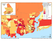
In the five years between 1996 and 2001, the population of Kingston grew by 1.6%, compared with an increase of 6.1% for Ontario as a whole. Population density of Kingston averaged 77.0 inhabitants per square kilometre (199/sq mi), compared with an average of 12.6/km2 (33/sq mi) for Ontario altogether.
The population of Kingston shows significant turnover because of its relatively large student population (about 10%) and the number of military residents associated with Canadian Forces Base Kingston.
According to the Government of Canada 2006 census, 94.2% of the population were Caucasian; of the visible minorities, 1.7% were Chinese, 1.2% were South Asian, and 0.8% were black.
Detailed socio-demographic analysis and information about Kingston can be found in the Kingston Community Profile, 2009: A Socio-Demographic Analysis of Kingston, Ontario Canada.[42]
Religion
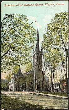
In 2011, there were 78,800 Kingston residents, or about two-thirds of the population, that were members of Christian groups; the largest were Roman Catholics, who numbered 33,410 (28.1%), the United Church of Canada (15,520 or 13.0%), and the Anglican Church of Canada (12,340 or 10.5%).
The Presbyterian Church was particularly influential in the 19th century development of Kingston post-secondary education. The church was a founder and financial supporter of Queen's University until 1912 when it was agreed that the university should become a secular institution.[43] Sir John A. Macdonald was also a member of St. Andrew's Presbyterian Church in Kingston.
Groups other than Christians and the non-religious include Muslims (1,735 or 1.5%), Jews (785 or 0.7%), and Hindus (520 or 0.4%).[44]
A total of 35,435 people, or 29.8% of the population, identified as non-religious.
Quality of life
Kingston was recognized as one of the "best places to live and work in Canada for young professionals". The city ranked # 4 on a list of 27 Canadian cities with a population of 100,000 or more in a study of the likes and dislikes of professionals between the ages of 20-40. The study, by Next Generation Consulting, considered factors such as: earning potential (things like employment opportunities and household incomes), cost of lifestyle (the cost of food, clothing and housing), vitality (air and water quality and green space) and after hours activities (things to do during week nights and on the weekend).[45][46]
A persistently low rental housing vacancy rate has had a negative effect on housing affordability in Kingston for a number of years. Average two bedroom rents exceeded $1,000.00 per month by early 2013.[47]
The Canadian Centre for Policy Alternatives published a report that ranked Canada's 25 largest cities on quality of life for women. Based on 2013 numbers, Kingston placed: 5th in Economic Security; 15th in Health; 22nd in Leadership; and 23rd in Security. Overall, the city was positioned in 17th place.[48]
Economy
Kingston's economy relies heavily on public sector institutions and establishments. The most important sectors are related to health care, education (Queen's University, the Royal Military College of Canada, and St. Lawrence College), government (including the military and correctional services), tourism and culture. Manufacturing, and research and development play a smaller role than in the past. The private sector accounts for half of Kingston's employment.[49] One of Kingston's major industrial employers of the 20th century, the Canadian Locomotive Company, closed in 1969, and the former Alcan and DuPont operations employ far fewer people than in the past. But due to the city's central location between Toronto, Ottawa, Montreal and Syracuse, NY a trucking and logistics warehousing industry has developed.
According to the Kingston Economic Development Corporation, the major employers in Kingston as of December 2014 were:[49]
- Canadian Forces Base Kingston (includes the Royal Military College of Canada and military and civilian personnel) 9,642
- Queen's University 7,000
- Kingston General Hospital 4,119
- Limestone District School Board 3,100
- Correctional Service of Canada 2,348
- City of Kingston 1,286
- Providence Care 1,175
- Hotel Dieu Hospital 900
- Invista Canada (formerly DuPont): 800
- StarTek Canada 690
- Calian Group 600
- Empire Life Insurance Company 600
- Ministry of Health and Long-Term Care 569
- Ongwanada 500
- J.E. Agnew Food Services Ltd. (operates several Tim Hortons stores) 490
- Bell Canada 415
- Novelis Works Manufacturing (formerly Alcan) (Rolled Products and R&D Centre) 270
- Tim Horton's Inc. Distribution Centre 259
- Commissionaires Canada 250
- Assurant Solutions 180
Transportation
Highway 401, which runs in the north part of the city, is the principal access route into Kingston. The first sections of the highway in the Kingston area were opened in 1958, although it was not fully completed for another ten years. Highway 15 is an alternative route between Kingston and the Ottawa region. From the south, Interstate 81 connects with Highway 401 east of Kingston.
Seasonal ferry service from Cape Vincent, New York, via Wolfe Island, into downtown Kingston is an alternate route to and from the United States.
Via Rail corridor service connects Kingston along the main line between Windsor, Ontario and Quebec City.
By air, Kingston is served by Norman Rogers Airport with Air Canada Express providing regular service to Toronto Pearson only.
Megabus (Coach Canada) and Greyhound Canada provide service from the Kingston Bus Terminal to Toronto, Ottawa and Montreal. A Toronto Pearson Airport shuttle is also operated from Kingston via Belleville and Port Hope. Shuttle Kingston was reported in 2013 to connect to Watertown and Syracuse.[50][51]
Kingston Transit provides local municipal bus service.
Tourism

According to Statistics Canada, the tourism industry in Kingston represents a vital part of the city's economy. In 2004, over 3,500 jobs were contributed to Kingston's economy due to the tourism industry. The tourism industry has been at a healthy growth rate and has become one of the most performing sectors of Kingston. Unique opportunities are presented for this industry in this time of shifting travel trends and the baby boomer generation. The success of Kingston's tourism industry is heavily dependent on information about travelers, however data availability still remains a challenge.[52]
Kingston has launched several tourism campaigns including: Downtown Kingston!, and Yellow Door. The city launched a campaign to attract more traffic to downtown Kingston. The campaigns mission statement promises, “to promote downtown Kingston as the vibrant and healthy commercial, retail, residential, and entertainment centre of our region, attracting more people to live, shop, work and gather”.[53] The downtown area of Kingston is known as the central business district, and is the gathering place for various events including: the Kingston Buskers Rendezvous, FebFest, the 1000 Islands Poker Run and The Limestone City Blues Festival.
Alternatively, Yellow Door promotes tourism to the entire city. The goal of the campaign is to increase the consumer’s exposure to Kingston tourism, while remaining financially reasonable.[54] A yellow door was used as a metaphor for Kingston – and the good times people have – and used street workers to gather potential tourists from nearby Toronto and Ottawa. "Yellow Door" promotes interest by offering potential tourists a trip to Kingston. In 2013, Yellow Door received the Tourism Advertising Award of Excellence for the marketing and promotion of an Ontario tourism product.[54]
Culture
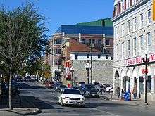
Kingston hosts several festivals during the year, including the Kingston WritersFest, Limestone City Blues Festival, the Kingston Canadian Film Festival, Artfest, the Kingston Buskers' Rendezvous, Kingston Jazz Festival, Reelout Film Festival, Feb Fest and the Wolfe Island Music Festival.
Kingston is home to many artists who work in visual arts, media arts, literature, and a growing number who work in other time-based disciplines such as performance art. The contemporary arts scene in particular has two long standing professional non-profit venues in the downtown area, the Agnes Etherington Art Centre (founded 1957), and Modern Fuel Artist-Run Centre (founded 1977). Local artists often participate in the exhibition programming of each organization, while each also presents the work of artists from across Canada and around the world - in keeping with their educational mandates. Alternative venues for the presentation of exhibition programs in Kingston include the Union Gallery (Queen's University's student art gallery), Verb Gallery, Open Studio 22, the Kingston Arts Council gallery, The Artel: Arts Accommodations and Venue, and the Tett Centre for Creativity and Learning.
The Kingston WritersFest[55] occurs annually. For over four decades the Ukrainian Canadian Club of Kingston has hosted the "Lviv, Ukraine" pavilion as part of the Folklore tradition, holding this popular cultural and folk festival annually on the second full weekend in June (at Regiopolis-Notre Dame High School). Literary events also happen throughout the year at the Kingston Frontenac Public Library and local bookstores. Writers who are or have been residents of Kingston include Steven Heighton, Bronwen Wallace, Helen Humphreys, Michael Ondaatje, Diane Schoemperlen, Michael Crummey, Mark Sinnett, Mary Alice Downie, Robertson Davies, Wayne Grady, Merilyn Simonds, Alec Ross, Jamie Swift and Carolyn Smart.
Music and theatre venues include The Grand Theatre, and The Wellington Street Theatre, which host performances from international, national, and local groups like Domino Theatre, Theatre Kingston, The Vagabond Repertory Theatre Company, Hope Theatre Projects, Bottle Tree Productions, and other small groups that dot the downtown area. The Kingston Symphony performs at The Grand Theatre, as do several amateur and semi-professional theatre groups. The K-Rock Centre, a 5,800-seat entertainment venue and ice rink, opened in February 2008.
The city has spawned several musicians and musical groups, most of whom are known mainly within Canada, but a few of whom have achieved international success. These include John Kay, lead singer, harmonica and organ player, and occasional guitarist of the heavy metal late 60s/early 70s band Steppenwolf, members of The Tragically Hip, The Glorious Sons, The Mahones, jazz singer Andy Poole, Bedouin Soundclash, Sarah Harmer, The Arrogant Worms, The Headstones, The Inbreds, PS I Love You and members of Moist, including singer David Usher.
Kingston is also the birthplace of Bryan Adams. The first winner of the television series Canadian Idol was Kingston native Ryan Malcolm.
Poet Michael Andre was raised in Kingston. Zal Yanovsky of The Lovin' Spoonful lived in Kingston until his death in 2002.
Comedian and actor Dan Aykroyd has a residence just north of Kingston and is a frequent face in town. He was briefly a minor partner in a restaurant called Aykroyd's Ghetto House Café on upper Princess Street during the 1990s which prominently featured a Blues Brothers' car projecting out from the second story wall.
Education
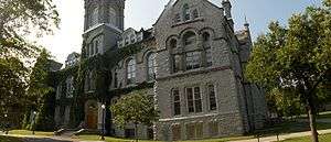
Kingston is the site of two universities, Queen's University and the Royal Military College of Canada, and a community college, St. Lawrence College. According to Statistics Canada, Kingston has the most PhD-holders per capita of any city in Canada.[56]
Queen's University
Queen's University is one of Canada's oldest universities and offers a variety of degree programs. The university was founded in 1841 under royal charter from Queen Victoria. It currently has an enrollment of nearly 25,000 students. Queen's Main Campus is rather self-contained, but is in close walking distance to downtown Kingston, making it a pedestrian friendly university for students and faculty alike.
Royal Military College of Canada
The Royal Military College of Canada, established in 1876, is Canada's only military university (Collège Militaire Royal in Saint-Jean-sur-Richelieu, Quebec is a military college), providing academic and leadership training to officer cadets, other members of Canada's armed forces and civilians. There are currently 1,100 undergraduate students and 500 full and part-time graduate students.[57]
St. Lawrence College
St. Lawrence College offers baccalaureate degree programs at its Kingston campus, in behavioural psychology, industrial trades, microelectronics, nursing and business administration (the latter via a partnership with Laurentian University[58]), in addition to certificate, diploma, and advanced diploma programs.
Primary and secondary education
The Limestone District School Board serves students in the City of Kingston and the counties of Frontenac and Lennox and Addington. Along with the Limestone School of Community Education, which provides adult education and training programs, approximately 21,000 students attend 70 elementary and secondary schools along with supporting education centres. The Algonquin and Lakeshore Catholic District School Board serves students of the Roman Catholic faith. Approximately 12,800 students attend 36 elementary schools and 5 secondary schools in this district. The Catholic high schools in the immediate Kingston area include Regiopolis Notre-Dame and Holy Cross Catholic High Schools. The francophone community is served by two school boards, the Conseil des écoles publiques de l'Est de l'Ontario and the Conseil des écoles catholiques du Centre-Est, each providing one secondary school in the area.
Secondary schools located in Kingston:
- Bayridge Secondary School
- École secondaire catholique Marie-Rivier
- École secondaire publique Mille-Îles
- Frontenac Secondary School
- Holy Cross Catholic Secondary School
- Kingston Collegiate and Vocational Institute
- La Salle Secondary School
- Leahurst College High School
- Loyalist Collegiate and Vocational Institute
- Queen Elizabeth Collegiate and Vocational Institute
- Regiopolis-Notre Dame Catholic Secondary School
Correctional institutions and facilities
Kingston has the largest concentration of federal correctional facilities in Canada. The facilities are operated by the Correctional Service of Canada. Of the nine institutions located in the Kingston area, seven of them are located within the municipal boundaries of the city.
- Kingston Penitentiary (maximum security) (Officially closed September 30, 2013).[59]
- Regional Treatment Centre (multi-level security), co-located within Kingston Penitentiary
- Joyceville Institution (medium security)
- Pittsburgh Institution (minimum security), co-located with Joyceville
- Collins Bay Institution (medium security)
- Frontenac Institution (minimum security), co-located with Collins Bay
- Millhaven Institution (maximum security), and Bath Institution (medium security), are located in the nearby village of Bath.
Until 2000, Canada's only federal correctional facility for women, the Prison for Women (nicknamed "P4W") was also located in Kingston. As a result of the report of the Commission of Inquiry into Certain Events at the Prison for Women in Kingston, the facility was closed in 2000. Queen's University purchased the property with the intention of renovating it to house the Queen's Archives, but the interior of the building was awarded a heritage designation and Queen's lost the ability to renovate the interior and is currently considering its options.
In September 2013, after almost 180 years of housing prisoners, Kingston Penitentiary closed. The maximum security prison was named a National Historic Site of Canada in February 1990 due to its history and reputation. In its year early years, the prison had a vital role in constructing the city. The prison brought prosperity to Kingston, and along with eight other prisons being built in the area, helped create an impressive local economy.[60]
Geography and climate
Kingston is located within the Mixedwood Plains Ecozone, and is dominated in the Kingston area by a mixture of deciduous and coniferous tree species and abundant water resources[61][62] The region is underlain mosty by Ordovician limestone of the Black River Group.[63]
Being within hardiness zone 5, Kingston has a moderate humid continental climate (Köppen climate classification Dfb).[64] It has cooler summers and colder winters than most of Southern Ontario. Although proximity to Lake Ontario has a moderating effect on the climate, it also tempers the heat and can on occasion increase precipitation, especially during heavy snowfall events. Mild to strong breezes off of Lake Ontario make Kingston one of the most consistently windy cities in Canada, especially near the water. As a result of the moderation the all-time high is a relatively modest 35.6 °C (96 °F) recorded on 9 July 1936.[65] However, due to the humidity, the humidex values for such days are very high. The coldest temperature ever recorded in Kingston was −35.6 °C (−32 °F) on 17 February 1896.[66]
The central part of the city is located between the Cataraqui River to the east and the Little Cataraqui Creek to the west, with outlying areas extending in both directions. The eastern part of the city is accessible by the La Salle Causeway on Highway 2.
Major features of Kingston's waterfront include Flora MacDonald Confederation Basin, Portsmouth Olympic Harbour, Collins Bay, Wolfe Island, Garden Island, the Cataraqui River (including the Inner Harbour and, within that, Anglin Bay).
| Climate data for Kingston, 1981−2010 normals,[lower-alpha 1] extremes 1872−present[lower-alpha 2] | |||||||||||||
|---|---|---|---|---|---|---|---|---|---|---|---|---|---|
| Month | Jan | Feb | Mar | Apr | May | Jun | Jul | Aug | Sep | Oct | Nov | Dec | Year |
| Record high °C (°F) | 13.5 (56.3) |
14.4 (57.9) |
24.0 (75.2) |
30.7 (87.3) |
31.7 (89.1) |
35.0 (95) |
35.6 (96.1) |
34.5 (94.1) |
33.3 (91.9) |
25.1 (77.2) |
21.1 (70) |
16.1 (61) |
35.6 (96.1) |
| Average high °C (°F) | −3.1 (26.4) |
−2.1 (28.2) |
2.9 (37.2) |
10.3 (50.5) |
16.4 (61.5) |
21.7 (71.1) |
24.9 (76.8) |
24.1 (75.4) |
19.5 (67.1) |
13.1 (55.6) |
7.0 (44.6) |
0.8 (33.4) |
11.3 (52.3) |
| Daily mean °C (°F) | −7.6 (18.3) |
−6.6 (20.1) |
−1.6 (29.1) |
5.7 (42.3) |
11.8 (53.2) |
17.0 (62.6) |
20.4 (68.7) |
19.6 (67.3) |
15.0 (59) |
8.9 (48) |
3.2 (37.8) |
−3.3 (26.1) |
6.9 (44.4) |
| Average low °C (°F) | −12 (10) |
−11.1 (12) |
−6.1 (21) |
1.1 (34) |
7.1 (44.8) |
12.3 (54.1) |
15.8 (60.4) |
15.1 (59.2) |
10.5 (50.9) |
4.5 (40.1) |
−0.6 (30.9) |
−7.4 (18.7) |
2.4 (36.3) |
| Record low °C (°F) | −34.5 (−30.1) |
−35.6 (−32.1) |
−27.8 (−18) |
−17.2 (1) |
−6.1 (21) |
0.6 (33.1) |
6.0 (42.8) |
3.3 (37.9) |
−1.7 (28.9) |
−7.5 (18.5) |
−25.6 (−14.1) |
−34.4 (−29.9) |
−35.6 (−32.1) |
| Average precipitation mm (inches) | 65.2 (2.567) |
65.1 (2.563) |
69.2 (2.724) |
87.1 (3.429) |
76.9 (3.028) |
72.0 (2.835) |
64.0 (2.52) |
93.7 (3.689) |
89.7 (3.531) |
92.4 (3.638) |
100.3 (3.949) |
84.1 (3.311) |
959.6 (37.78) |
| Average rainfall mm (inches) | 29.2 (1.15) |
29.0 (1.142) |
41.3 (1.626) |
77.5 (3.051) |
76.9 (3.028) |
72.0 (2.835) |
64.0 (2.52) |
93.7 (3.689) |
89.7 (3.531) |
91.0 (3.583) |
92.4 (3.638) |
52.2 (2.055) |
808.7 (31.839) |
| Average snowfall cm (inches) | 39.5 (15.55) |
39.1 (15.39) |
25.4 (10) |
8.1 (3.19) |
0.0 (0) |
0.0 (0) |
0.0 (0) |
0.0 (0) |
0.0 (0) |
1.2 (0.47) |
8.0 (3.15) |
35.9 (14.13) |
157.1 (61.85) |
| Average precipitation days (≥ 0.2 mm) | 16.1 | 13.9 | 12.8 | 13.5 | 12.9 | 11.4 | 9.3 | 11.1 | 12.3 | 13.7 | 16.2 | 15.8 | 159.1 |
| Average rainy days (≥ 0.2 mm) | 5.4 | 5.1 | 8.2 | 11.9 | 12.9 | 11.4 | 9.3 | 11.1 | 12.3 | 13.6 | 14.0 | 8.1 | 123.4 |
| Average snowy days (≥ 0.2 cm) | 13.2 | 11.1 | 7.3 | 2.6 | 0.0 | 0.0 | 0.0 | 0.0 | 0.0 | 0.40 | 4.3 | 11.5 | 50.4 |
| Mean monthly sunshine hours | 93.2 | 113.1 | 144.2 | 161.8 | 218.0 | 243.7 | 279.3 | 238.7 | 164.4 | 139.7 | 89.5 | 73.1 | 1,958.8 |
| Percent possible sunshine | 32.4 | 38.5 | 39.1 | 40.2 | 47.7 | 52.6 | 56.5 | 55.0 | 43.7 | 40.9 | 30.9 | 26.4 | 42.2 |
| Source: Environment Canada[67][68][69][70][71] | |||||||||||||
Cities and towns nearby
| North West Tweed 89.6 km (55.7 mi) Tamworth 55.7 km (34.6 mi) Enterprise 50.2 km (31.2 mi) |
^ North Elginburg 10 km (6 mi) Sydenham 20 km (12 mi) Westport 50 km (31 mi) Sharbot Lake 65 km (40 mi) |
North East Ottawa 150 km (93 mi) Brockville 75 km (47 mi) |
| < West Amherstview 12 km (7 mi) Odessa 14 km (9 mi) Bath 23 km (14 mi) Greater Napanee 37 km (23 mi) Belleville 70 km (43 mi) |
KINGSTON | East > Howe Island 12 km (7 mi) Gananoque 28 km (17 mi) Clayton, New York 32 km (20 mi) Alexandria Bay, New York 47 km (29 mi) |
| Amherst Island 11 km (7 mi) Picton 58 km (36 mi) Prince Edward County South West |
Lake Ontario Syracuse, New York 134 km (83 mi)
|
Wolfe Island 5 km (3 mi) Cape Vincent (village), New York 16 km (10 mi) Watertown, New York 53 km (33 mi) Jefferson County, New York South East |
Major parks and features nearby
|
North West |
^ |
North East |
|
< West |
KINGSTON |
|
|
Lake on the Mountain Provincial Park |
Lake Ontario |
Adirondack Park, New York |
Sports
Hockey
Kingston lays claim to being the birthplace of ice hockey, though this is contested. Support for this is found in a journal entry of a British Army officer in Kingston in 1843. He wrote "Began to skate this year, improved quickly and had great fun at hockey on the ice.".[72] Kingston is also home to the oldest continuing hockey rivalry in the world by virtue of a game played in 1886 on the frozen Kingston harbour between Queen's University and the Royal Military College of Canada. To mark this event, the city hosts an annual game between the two institutions, played on a cleared patch of frozen lake with both teams wearing period-correct uniforms and using rules from that era. The two schools also contest the annual Carr-Harris Cup, named for Lorne Carr-Harris, under modern competitive conditions to commemorate and continue their rivalry.
The Memorial Cup, which serves as the annual championship event for the Canadian Hockey League, began in 1919 on the initiative of Kingstonian James T. Sutherland. The first championship was held in Kingston. Sutherland, a member of the Hockey Hall of Fame, also helped establish the annual exhibition game between the Royal Military College of Canada and the United States Military Academy (West Point) in 1923.
Kingston is represented in the Ontario Hockey League (OHL) by the Kingston Frontenacs, and in Ontario Junior Hockey League (OJHL) by the Kingston Voyageurs. The Frontenacs General Manager is Kingston native Doug Gilmour.
The International Hockey Hall of Fame, was established in September 1943 with a building constructed in 1965. The original building was located near the Kingston Memorial Centre (which was opened in 1950), but has since been relocated to Kingston's west end at the Invista Centre. The International Hockey Hall of Fame, founded by the National Hockey League (NHL) and the Canadian Amateur Hockey Association, is the oldest sports hall of fame in Canada.[73] The museum’s collection is home to various items that pay homage to Kingston’s role in the history of hockey in Canada. These include: the original square hockey puck from the first Queens University vs. the Royal Military College of Canada (RMC) game in 1886, hockey’s oldest sweater worn by a Queen’s student in 1894, and Canada’s first Olympic gold medal from 1924, among others.[74]
New to the city is the K-Rock Centre, located in the downtown core. The arena opened in February 2008, and serves as home ice for the Frontenacs. The Voyageurs play at the new Invista Centre, located in the city's west end.
Soccer
Kingston Clippers Soccer Club compete in the men's and women's divisions of the semi-professional League1 Ontario. League and L1O Cup matches are played from May through October.
Sailing
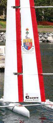
The city is known for its fresh-water sailing, and hosted the sailing events for the 1976 Summer Olympics. CORK — Canadian Olympic-training Regatta, Kingston — now hosted by CORK/Sail Kingston Inc. is still held every August. Since 1972, Kingston has hosted more than 40[75] World and Olympic sailing championships. Kingston is listed by a panel of experts among the best yacht racing venues in the USA,[76] even though Kingston is in Canada.
Kingston sits amid excellent cruising and boating territory, with easy access to Lake Ontario, the St. Lawrence River, and the Thousand Islands including the St. Lawrence Islands National Park.
Kingston is also home to the youth sail training ship called the St. Lawrence II.
During the summers, the RMC campus in Kingston plays host to a Royal Canadian Sea Cadets camp called HMCS Ontario, which provides sail training along with lots of other training to youth from across Canada. The Kingston Yacht Club located in downtown Kingston has a learn to sail program for both children and adults.
Diving
Kingston is known for fresh-water wreck diving. Kingston's shipwrecks are well preserved by its cool fresh water, and the recent zebra mussel invasion has caused a dramatic improvement in water clarity that has enhanced the quality of diving in the area.
Golf
The Kingston area has eight golf courses, two of which are entirely public.[77] The Kingston Golf Club, established in 1884, was a founding member of the Royal Canadian Golf Association in 1895; however, this club ceased operating in the mid-1920s. The first winner of the Canadian Amateur Championship that same year was Kingstonian Thomas Harley, a Scottish immigrant carpenter. Richard H. (Dick) Green, who immigrated to the area from England in the late 1920s, was the longtime club professional for nearly 40 years at Cataraqui Golf and Country Club (founded in 1917 and redesigned by Stanley Thompson in 1930). Green also helped design several courses in eastern Ontario, including Smiths Falls (1949), Glen Lawrence (1955), Rideau Lakes (1961), Amherstview (1971), Garrison (1971), Evergreen (1972), Belle Park Fairways (1975), Rivendell (1979), and Colonnade (1984). Matt McQuillan, a professional player on the PGA Tour for the 2011 and 2012 seasons, was born and raised in Kingston, and developed his game at the Garrison Golf and Curling Club. McQuillan won the 2005 Telus Edmonton Open on the Canadian Professional Golf Tour.
Curling
Three curling clubs are located in the Kingston area: the Cataraqui Golf & Country Club, Garrison Golf & Curling Club, and the Royal Kingston Curling Club.[78] The Royal Kingston Curling Club (RKCC) was founded in 1820, and was granted Royal patronage in 1993. In 2006, the RKCC moved to a new facility at 130 Days Road, to make way for the construction of a new complex at Queen's University, the Queen's Centre.
Rugby
The Kingston Panthers Rugby Football Club (KPRFC) was founded in 1959, and from that moment onward has established a reputation as a strong community player. KPRFC is a non-profit organization answering directly to the Eastern Ontario Rugby Union (EORU), the Ontario Rugby Union (ORU), and Rugby Canada (RC). The Kingston Panthers R.F.C, recently celebrated their fortieth anniversary with an EORU championship in the Division 1 championship game at Twin Elm Rugby Park in Ottawa, Ontario.
Football
The earliest known incarnation of an organized football team in Kingston is the Kingston Granites which played in the predecessor league to the Canadian Football League, the Ontario Rugby Football Union, (ORFU). The team played for four seasons between 1898 and 1901 winning 1 ORFU title in 1899 defeating the Ottawa Rough Riders 8-0. Kingston also hosted the 10th Grey Cup on December 2, 1922. The Limestone Grenadiers now represent Kingston and the surrounding area in the OVFL. The Club franchise catchment area draws players from Frontenac, Hastings, Lanark, Leeds, Lennox and Prince Edward counties. League play runs from late May through August. The Junior and Varsity teams' main schedule pits the Grenadiers against eastern Ontario opponents and cross-over games with western Ontario teams leading to a provincial title championship game. Many notable football people, CFL, NFL players, coaches and personalities have been associated with Kingston including:
Notable people
Media
See also
- List of sister cities in Canada
- Cartwright Point, Ontario
- Inner Harbour, Kingston
- Sydenham Ward
- Kingston Mills
- Portsmouth, Kingston
- Rideau Heights, Kingston
- Royal eponyms in Canada
- HMCS Kingston (MM 700)
References
Notes
- ↑ Normals are based on climate data recorded at Kingston/Norman Rogers Airport from 1981 to 1996.
- ↑ Extreme high and low temperatures in the table below were recorded at Queen's University from July 1872 to March 1957, at Kingston (Ontario Hydro) from April 1957 to June 1967, at Kingston/Norman Rogers Airport from July 1967 to September 1996, at Kingston Pumping Station from October 1996 to November 2007 and at Kingston/Norman Rogers Airport from July 2008 to present.
- ↑ "Ottawa Valley election results: Mayoral Races". CTV Ottawa. October 28, 2014. Retrieved November 4, 2014.
- ↑ Environment Canada Website
- ↑ Osborne 2011, p. 81
- ↑ Quebec History - Cataraqui Retrieved April 12, 2014
- ↑ Cataraqui Archaeological Research Foundation Retrieved April 12, 2014
- ↑ Histoires de Bâtiment - Naval Historic Sites - Kingston Retrieved April 12, 2014
- ↑ All About Canada, Kingston, Ontario-Settlement and Early Days Retrieved April 12, 2014
- ↑ Armstrong 1973, p.67.
- ↑ "Chronology of the History of Kingston". Kingston Historical Society. Retrieved June 28, 2012.
- ↑ Archaeology in the County - Traces of the First People in Prehistoric Prince Edward County Retrieved March 4, 2015
- ↑ The Archaic Period. Ontario Archaeological Society Retrieved March 4, 2015
- ↑ Late Woodland Period. Ontario Archaeological Society Retrieved March 4, 2015
- 1 2 Kingston Archaeology - Belle Island Retrieved February 27, 2015
- ↑ Adams 1986, p.6
- ↑ Adams 1986, pp.5,9
- ↑ Osborne 2011, pp. 13,19
- ↑ Osborne 2011, pp. 18
- ↑ Osborne 2011, pp. 19-21
- ↑ Osborne 2011, pp. 150-154
- ↑ "The Typhus Epidemic 1847". Ontario's Historical Plaques. Archaeological and Historic Sites Board of Ontario. Retrieved January 24, 2012.
- ↑ "Kingston General Hospital National Historic Site of Canada". Parks Canada. Government of Canada. Archived from the original on July 1, 2013. Retrieved February 12, 2013.
- ↑ City receives grant to complete Brownfield study of Davis Tannery lands. Kingstonregion.com. October 23, 2013 Retrieved September 22, 2015
- ↑ Mika Mika 1987, p. 124
- ↑ Fire and gunpowder explosions demolished Kingston's waterfront. Kingston Whig-Standard. February 8, 2010 Retrieved October 8, 2015
- ↑ Kingston Public Market History Retrieved October 8, 2015
- ↑ Osborne 2011, p. 99
- ↑ Osborne 2011, p. 50
- ↑ Mika 1987, p. 44
- ↑ The Victorian Soldier - History and Uniform of the Royal Canadian Horse Artillery, 1871 to 1970 Retrieved September 10, 2011
- ↑ Anson Keill's Second class certificate from the School of Military Instruction, Kingston
- ↑ Richard Preston 'Canada's RMC: A History of the Royal Military College of Canada' published by the RMC Club by U of Toronto Press.
- ↑ "Internment Camps in Canada during the First and Second World Wars". Library and Archives Canada. Retrieved September 5, 2014.
- ↑ "Heritage Properies Register". Official site. City of Kingston. Retrieved March 4, 2015.
- ↑ "Rideau Canal". World Heritage Centre. UNESCO. Retrieved September 8, 2011.
- ↑ "Canada". World Heritage Centre. UNESCO. Retrieved September 8, 2011.
- ↑ Kingston, Directory of Federal Heritage Designations, Parks Canada
- ↑ Community Profiles from the 2006 Census, Statistics Canada - Census Subdivision
- ↑ Aboriginal Peoples - Data table
- ↑ "Statistics Canada 2011 Census for Kingston". 2.statcan.ca. February 8, 2012. Retrieved February 9, 2012.
- ↑ "Statistics Canada 2011 Census for Census Metropolitan Area of Kingston". 2.statcan.ca. February 8, 2012. Retrieved February 9, 2012.
- ↑ Statistics Canada 2006 Census for Kingston Metropolitan Area
- ↑ "Kingston Community Profile 2009: A Socio-Demographic Analysis of Kingston,Ontario,Canada". Spckingston.ca. June 30, 2009. Retrieved March 2, 2011.
- ↑ "History of the University". website. Queen's University. Retrieved February 4, 2014.
- ↑ "National Household Survey (NHS) Profile, 2011". Statistics Canada. May 10, 2013. Retrieved August 29, 2013.
- ↑ "Next Cities-Canada Version Press Release (PDF, 324 KB)" (PDF). Archived from the original (PDF) on July 14, 2011. Retrieved March 2, 2011.
- ↑ McNeill, Murray (July 30, 2009). "Delighted to be a 'Pegger". Winnipeg Free Press. Retrieved March 2, 2011.
- ↑ CMHC (Spring 2012). "Housing Market: Kingston CMA" (PDF). www.cmhc.ca/housingmarketinformation. Canada Mortgage and Housing Corporation. p. 5. Retrieved July 16, 2012.
- ↑ http://www.thewhig.com/2015/07/17/city-gets-low-marks-for-womens-quality-of-life
- 1 2 Kingston Major Employers Retrieved: March 15, 2015
- ↑ syracuse.com: "New Kingston to Syracuse shuttle targets shoppers, air travelers" 10 Apr 2013
- ↑ thewhig.com: "Shuttling off to Syracuse" 3 Apr 2013
- ↑ Fritsche, Alexander. "Kingston's Tourism Industry" (PDF). May 21, 2008. KingstonCanada.com. Retrieved May 1, 2011.
- ↑ Downtown Kingston! Business Improvement Area, “About Us”, “Downtown Kingston!”
- 1 2 Dick Mathison, “Yellow Door Campaign Receives Tourism Advertising Award”, “Kingston Herald”, November 26, 2013
- ↑ Kingston WritersFest
- ↑ "CANOE Travel - Canada - Smartest city in Canada". Travel.canoe.ca. Retrieved March 2, 2011.
- ↑ "Directory of Canadian Universities - RMC". Aucc.ca. February 25, 2011. Retrieved March 2, 2011.
- ↑ "Degree Programs". St. Lawrence College. Retrieved April 14, 2009.
- ↑ "Kingston Penitentiary, Canada's most notorious prison, officially closes its doors", CTV News. Retrieved September 30, 2013
- ↑ Steve Cameron, “Kingston Penitentiary: Canada’s most famous prison closes its doors”, “The Globe and Mail”, September 29, 2013
- ↑ Ecological Framework of Canada - Mixedwood Plains Ecozone. Retrieved 30 April 2016
- ↑ Landforms and Climate of the Mixedwood Plains Ecozone. (Archived). Retrieved 30 April 2016
- ↑ Chapman, L.J. and D.F. Putnam. The Physiography of Southern Ontario. University of Toronto Press, 1973. pp 62, 316.
- ↑ "Kingston, Ontario Climate Summary". Weatherbase. Retrieved 3 January 2016.
- ↑ "Canadian Climate Data". Government of Canada. Retrieved 27 August 2016.
- ↑ "Canadian Climate Data". Government of Canada. Retrieved 27 August 2016.
- ↑ "Kingston A". Canadian Climate Normals 1981–2010. Environment Canada. Retrieved September 22, 2013.
- ↑ "Kingston Pumping Station". Government of Canada. Retrieved 20 May 2016.
- ↑ "Kingston Ont Hydro". Government of Canada. Retrieved 27 August 2016.
- ↑ "Kingston Queens U". Government of Canada. Retrieved 27 August 2016.
- ↑ "Kingston Climate". Government of Canada. Retrieved 27 August 2016.
- ↑ "Hockey night in Kingston". Retrieved June 21, 2006.
- ↑ Original Hockey Hall of Fame and Museum, “About the Hall”, “Original Hockey Hall of Fame and Museum”
- ↑ Original Hockey Hall of Fame and Museum, “The Top 10 Artifacts in the Museum”, “Original Hockey Hall of Fame and Museum”
- ↑ "List of Major Regattas in Kingston - Kingston , Ontario waterfront". K7waterfront.org. Retrieved March 2, 2011.
- ↑ "Scuttlebutt News Center: Best Racing Venues in the US". Sailingscuttlebutt.com. June 16, 2004. Retrieved March 2, 2011.
- ↑ OnGolf.ca - Kingston Golf Courses - Ontario Canada Retrieved March 2, 2011
- ↑ CurlingRink.ca - Kingston Curling Clubs and Rinks - Kingston, Ontario Retrieved March 2, 2011
Bibliography
- Adams, Nick.Iroquois Settlement at Fort Frontenac in the Seventeenth and Early Eighteenth Centuries. Ontario Archaeology, No. 46: 4-20. 1986.
- Armstrong, Alvin. Buckskin to Broadloom - Kingston Grows Up. Kingston Whig-Standard, 1973. No ISBN.
- Mika, Nick and Helma et al. Kingston, Historic City. Belleville: Mika Publishing Co., 1987. ISBN 0-921341-06-7.
- Mika, Nick and Helma. Kingston Heritage, Buildings, Monuments, Plaques Belleville: Mika Publishing Co., 1983, 160 pages.
- Osborne, Brian S. and Donald Swainson. Kingston, Building on the Past for the Future. Quarry Heritage Books, 2011. ISBN 1-55082-351-5
- Roy, James. Kingston: The King's Town. Toronto: McClelland and Stewart, 1952.
- Turner, Larry."The Founding of Kingston, Ontario". The Loyalist Gazette, Volume XXII, No. 1. Retrieved 2015-01-14
- Preston, Richard. Kingston Before the War of 1812: A Collection of Documents. Toronto: Champlain Society Publications, 1959.
External links
| Wikimedia Commons has media related to Kingston, Ontario. |
-
 Kingston, Ontario travel guide from Wikivoyage
 - Official City of Kingston Website
 |
South Frontenac | South Frontenac |  | |
| Loyalist | |
Leeds and the Thousand Islands | ||
| ||||
| | ||||
| St. Lawrence River Frontenac Islands |
