Killycluggin

Killycluggin (from Irish: 'Coil a Chlogáin' means "the Wood of the Bell-Shaped Stone"), is a townland in the civil parish of Templeport, County Cavan, Ireland. It lies in the Roman Catholic parish part of Templeport and barony of Tullyhaw.
Geography
Killycluggin is bordered on its north side by Tonyhallagh Townland, west side by Lissanover downland, east by Tonyrevan downland, and south by Bellaheady Townland in Kildallan Parish and by Kilnavert and Corran, County Cavan Townlands. Killycluggin's chief geographical features are a stream from Stone Quarry and a gravel pit.
Killycluggin is traversed by the R205 road (Ireland), minor roads, rural lanes, and the inactive Cavan and Leitrim Railway.It is located 5 miles from Bawnboy.
The townland covers 76 total acres. [1]
History
The 1609 Baronial Map depicts the townland as Killycluggin.[2] [3]
The 1665 Down Survey map depicts it as Killycraggan.[4]
Killycluggin was the site of the pre-Christian pagan god of Ireland Crom Cruach and the Killycluggin Stone, situated in a stone circle on Bannon’s farm in the townland.
In the Plantation of Ulster by grant dated 23 June 1610, along with other lands, King James VI and I granted "two polls of Kilclogen to Hugh Culme, esquire, as part of the Manor of Calva". Culme then surrendered his interest in "Kilcloghan" to Walter Talbot of Ballyconnell. Talbot died on 26 June 1625, at Ballyconnell, and his son James Talbot succeeded to the Killycluggin lands aged just 10 years old. James Talbot married Helen Calvert, daughter of George Calvert, 1st Baron Baltimore, in 1635, and had a son, Colonel George Talbot, who owned an estate in Cecil County, Maryland, which he named Ballyconnell in honour of his native town in Cavan. George Talbot was appointed surveyor-general of Maryland in 1683. In the aftermath of the Irish Rebellion of 1641, James Talbot's estate in Ballyconnell was confiscated in the Cromwellian Act for the Settlement of Ireland 1652 because he was a Catholic, and he was granted an estate in 1655 at Castle Rubey, County Roscommon instead. He died in 1687. The Talbot lands in Killycluggin were distributed as follows:
In the Hearth Money Rolls of 1662, there were three people paying the Hearth Tax in Kilclagan: Dorby Don, John Reade, and Thomas Teddy.
John Blachford obtained Killycluggin after the Cromwellian settlement. He was born in 1598 in Ashmore, Dorset, England, the son of Richard and Frances Blachford. He became a merchant in Dorchester, Dorset but fled to France in 1633 when facing a warrant from the Exchequer for not paying customs. He married Mary Renald from Devon, died at Lissanover, County Cavan in 1661, and was buried at St. Orvins in Dublin, despite wishing to be buried back in Dorchester. His will was published on 9 January 1665, leaving his son John Blachford as his sole heir. An inquisition held in Cavan on 21 May 1667 found that his widow Mary Blachford and his heir John were seized of, inter alia, the land of Killeclogine alias Killecragan. He had sons John, Thomas, Ambrose, and William (who became a major) and daughters Mary and Frances. Major William Blachford was born in 1658 and died at Lissanover on 28 March 1727. The Blachford family gravestones in Templeport Church read as follows: This monument was erected by MAJOR WILLIAM / BLASHFORD of Lisnover in 1721 to the memory of / his father, JOHN BLASHFORD, late of the same Esqr. but / from Dorchester in Dorsetshire, the place of his / nativity, who in his lifetime chose this for a burying / place, for himself and family, but died in Dublin / was buried in St. Orvins Church but his wife, MARY / RENALD of a Devonsheire family is buried here / as also three sons and two daughters, viz JOHN / AMBROSE AND THOMAS; MARY AND FRANCES / Here likewise lies buried two wives of MAJOR WILLIAM BLASHFORD, son to the said JOHN BLASHFORD viz / MARY MAGHEE of an ancient Family in Lincolnsheire. CORNET CHIDLEY BLACHFORD, son to MAJOR WILLIAM BLACHFORD, leys buried here who dyed August ye 29th, 1722. This aboue MAJOR WILLIAM BLACHFORD. / That erected this monument, died the 28th of March 1727, aged 69 years.
The Tithe Applotment Books for 1827 list four tithepayers in the townland.[5]
Griffith's Valuation of 1857 lists sixteen landholders in the townland.[6]
In the 1901 census of Ireland, there were ten families listed in the townland,[7] and in the 1911 census of Ireland, there were only nine families listed in the townland.[8]
Antiquities
There are several chief structures of historical interest in the town and the land.
- A Neolithic Stone Circle (Site number 62 in Archaeological Inventory of County Cavan, Patrick O’Donovan, 1995) [9] [10]
- A La Tène decorated standing stone called the Killycluggin Stone or the Crom Cruach Stone which was originally situate in the above stone circle but is now in Cavan County Museum (Site number 93 in Archaeological Inventory of County Cavan, Patrick O’Donovan, 1995) [11] [12] [13]
- A Bronze Age stone cist discovered when excavating the Killycluggin Stone (Site number 165 in Archaeological Inventory of County Cavan, Patrick O’Donovan, 1995) [14]
- A Megalithic Tomb (Site number 46 in Archaeological Inventory of County Cavan, Patrick O’Donovan, 1995)
- Two earthen ring-forts (Site numbers 774 and 775 in Archaeological Inventory of County Cavan, Patrick O’Donovan, 1995)
- An underground Souterrain discovered in ring-fort No. 774 above (Site number 1244 in Archaeological Inventory of County Cavan, Patrick O’Donovan, 1995)
- A Lime kiln
References
- ↑ "IreAtlas". Retrieved 29 February 2012.
- ↑ National Archives Dublin:
- ↑
- ↑ Trinity College Dublin: The Down Survey of Ireland.
- ↑ , in the Tithe Applotment Books 1827
- ↑
- ↑ Census of Ireland 1901
- ↑ Census of Ireland 1911
- ↑ Antiquities of the Irish Countryside by Seán P. Ó Ríordáin (1979), p.55
- ↑ The Shell Guide to Ireland, by Lord Killanin, M.V. Duignan and Peter Harbison (Editor) (1989), p.61.
- ↑ On a Stone with La Tène Decoration Recently Discovered in Co. Cavan, by R. A. S. Macalister, in The Journal of the Royal Society of Antiquaries of Ireland, Sixth Series, Vol. 12, No. 2 (Dec. 31, 1922), pp. 113-116.
- ↑ Excavations at Killycluggin, County Cavan by Barry Raftery, in Ulster Journal of Archaeology, Third Series, Vol. 41 (1978), pp. 49-54.
- ↑ Fragment of the Killycluggin Stone by Seán P. Ó Riordáin, in The Journal of the Royal Society of Antiquaries of Ireland, Vol. 82, No. 1 (1952), p. 68
- ↑ On a Stone with La Tène Decoration Recently Discovered in Co. Cavan, by R. A. S. Macalister, in The Journal of the Royal Society of Antiquaries of Ireland, Sixth Series, Vol. 12, No. 2 (Dec. 31, 1922), pp. 113-116.
External links
Places in County Cavan | ||
|---|---|---|
| Towns | 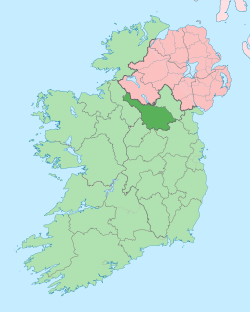 | |
| Villages |
| |
| Townlands | ||
| Landforms | ||
| ||
Coordinates: 54°04′31″N 7°48′37″W / 54.07514°N 7.810271°W