Keyport Harbor
| Keyport Harbor | |
|---|---|
| Brown's Point Cove | |
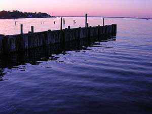 A portion of the Keyport Waterfront in Monmouth County, New Jersey | |
 Keyport Harbor Location of Keyport Harbor, in Northern Monmouth County, New Jersey | |
| Location | Keyport, New Jersey |
| Coordinates | 40°26′40.386″N 74°11′57.518″W / 40.44455167°N 74.19931056°WCoordinates: 40°26′40.386″N 74°11′57.518″W / 40.44455167°N 74.19931056°W |
| Type | Harbor |
| Part of | Raritan Bay |
| Primary inflows |
Luppatatong Creek Matawan Creek Chingarora Creek |
| Ocean/sea sources | Atlantic Ocean |
| Basin countries | United States |
| Managing agency | NY/NJ Baykeeper |
| Max. depth | 8 feet (2.4 m)[1] |
| Surface elevation | 0 feet (0 m)[1] |
Keyport Harbor is an arm of Raritan Bay, located on the south side of the bay. Streams flowing into Keyport Harbor include Matawan Creek, Luppatatong Creek and Chingarora Creek.
An earlier name for Keyport Harbor is Brown's Point Cove.
References
- 1 2 "REPORT OF CHANNEL CONDITIONS - Keyport Bay" (PDF). US Army Corp of Engineers. 20 October 2015. Retrieved 18 December 2015.
This article is issued from Wikipedia - version of the 12/27/2015. The text is available under the Creative Commons Attribution/Share Alike but additional terms may apply for the media files.