Kapiri Mposhi
| Kapiri Mposhi | |
|---|---|
| Town | |
|
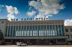
TAZARA station | |
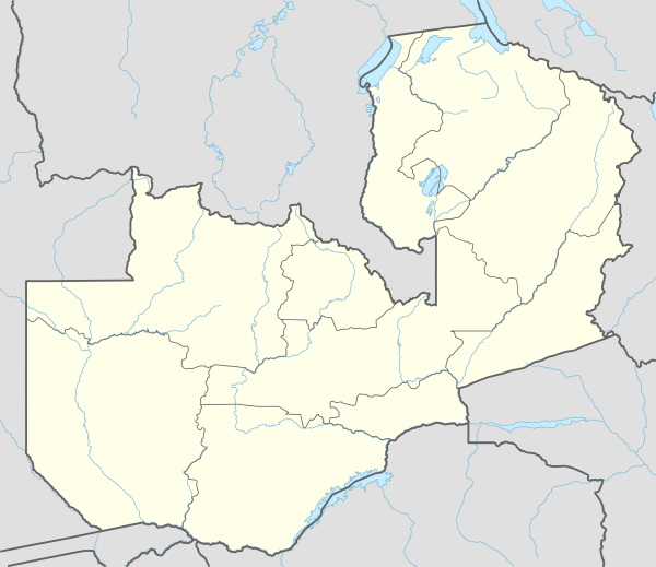
 Kapiri Mposhi Location of Kapiri Mposhi in Zambia | |
| Coordinates: ZM 13°58′38″S 28°41′5″E / 13.97722°S 28.68472°ECoordinates: ZM 13°58′38″S 28°41′5″E / 13.97722°S 28.68472°E | |
| Country |
|
| Province | Central |
| District | Kapiri Mposhi |
| Population (2010)[1] | |
| • Total | 14,792 |
| Time zone | CAT (UTC+2) |
| Climate | Cwa |
Kapiri Mposhi is a town Zambian town, seat of the Kapiri Mposhi District, Central Province. Located north of Lusaka, it stands on the Great North Road and is significant for the railway connection between Zambia Railways line from Kitwe to Lusaka and Livingstone and western terminal (New Kapiri Mposhi) of the Tanzania-Zambia Railway Authority from Dar es Salaam since 1976.
Geography
The town lies in the middle of Zambia, next to the borders with Copperbelt Province. The homonym district borders with the ones of Chibombo, Chisamba, Kabwe, Luano, Masaiti, Mkushi, Mpongwe and Ngabwe.[2]
Transport
Kapiri Mposhi has two railways stations, a TAZARA Railway station that connects it to Dar-es-Salaam and a Zambia Railways stations that connects it to Lusaka and Livingstone. The TAZARA Railway station is considerably larger and more modern than the Zambia Railways station.
Just north of the town, there is a major junction, with the road north to Mkushi, Serene, and the Tanzanian border going north-eastwards, and the road to the Copperbelt heading to the north west. This, combined with the railway links, makes Kapiri Mposhi an important point in the regional freight network.
Economy
Most shops and businesses in Kapiri Mposhi can be found along the main road and include a bakery, Pep and Barclays bank.
See also
References
- ↑ Central statistics office of Zambia: 2010 Census
- ↑ 776377628 Kapiri Mposhi on OpenStreetMap
External links
| Wikimedia Commons has media related to Kapiri Mposhi. |
![]() Kapiri Mposhi travel guide from Wikivoyage
Kapiri Mposhi travel guide from Wikivoyage
