Kallody

| Kallody <span class="nickname" lang="mal[1]">കല്ലോടി | |
|---|---|
| Village | |
| Etymology: കല്ല് (stone) and ഓടി (ran)[2] | |
 Location of Kerala (marked in red) in India | |
 Kallody  Kallody Location in Kerala, India | |
| Coordinates: 11°45′56.451″N 75°57′41.372″E / 11.76568083°N 75.96149222°ECoordinates: 11°45′56.451″N 75°57′41.372″E / 11.76568083°N 75.96149222°E | |
| Country |
|
| State | Kerala |
| District | Wayanad |
| Government | |
| • Type | Gram panchayat |
| Elevation[3] | 792 m (2,598 ft) |
| Languages | |
| • Official | Malayalam, English |
| Time zone | IST (UTC+5:30) |
| PIN | 670645 |
| Telephone Code | +91 4935 |
| Vehicle registration | KL-12(Wayanad RTO[4]), KL-72 (Mananthavady Sub-RTO[5]) |
| Coastline | 0 kilometres (0 mi) |
| Nearest city | Mananthavady |
| Literacy | 90% |
| Major Highway | Hill Highway (Kerala) SH-59 |
| Avg. summer temperature | +25 °C (77 °F) |
| Avg. winter temperature | +15 °C (59 °F) |
Kallody (കല്ലോടി) is a village in the Edavaka Gram panchayat of the Wayanad district, Kerala, India. This village falls under the Mananthavady Taluk. The Hill Highway (Kerala) SH-59 passes through this village town.
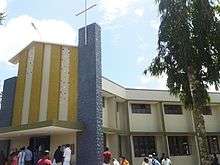
Kallody is home to the St. George Forane Church Kallody, Wayanad and Chowayil Bhagavathy Temple.
Etymology
The word Kallody is derived from the Malayalam words kallu–കല്ല് (i.e. stone) and ody–ഓടി (i.e. ran),[2] based on a century old tale of this area.
Long ago, the Kallody area was a forest. There was a hill named Choran Kunnu located on the banks of the Mananthavady-Pakranthalam hill pass. Thieves from this area used to attack merchants from Calicut to Mananthavady when they passed this hill pass. To escape from the attacks, the travellers used to carry stones with them and start running from this area. They used to pelt stones to defend from the thieves. Hence, this place named as Kallody.[2]
History
This land was divided into Edavaka and Edachena "desam". The house of Edachena Kunkan, one of the commanders of Pazhassi Raja, was located in this area.[2]
Kallody was mainly a place where people migrated from different parts of the central-south Kerala, especially from the area such as Kottayam, Thodupuzha, and Moovattupuzha starting from the year of 1940. Vettiyankal, Mathai was the first migrant to Kallody.[2] He invited several other migrants to Mananthavady to the Kallody area. The Nadukunnel family was one of the first families migrated from Pala to Kallody.
Education
The Kallody area is served by a several Kerala State aided schools and a couple of Anganwadis. The main schools are
- St. Joseph's Pre-Primary School Kallody
- St. Joseph's Upper-Primary (U.P.) School Kallody
- St. Joseph's High School (H.S.) Kallody
- St. Joseph's Higher Secondary School (H.S.S.) Kallody
Transportation
Kallody is mainly served by the Kerala State Road Transport Corporation (K.S.R.T.C.) buses. Other than the public transport system, Kallody residents use Motor Bikes, Auto rickshaws, or Taxicabs to commute.he Periya ghat road connects Mananthavady to Kannur and Thalassery. The Thamarassery mountain road connects Calicut with Kalpetta. The Kuttiady mountain road connects Vatakara with Kalpetta and Mananthavady. The Palchuram mountain road connects Kannur and Iritty with Mananthavady. The road from Nilambur to Ooty is also connected to Wayanad through the village of Meppadi.
The nearest railway station is at Mysore and the nearest airports are Kozhikode International Airport-120 km, Bengaluru International Airport-290 km, and Kannur International Airport, 58 km.
Points of Interest
- St. George Forane Church Kallody, Wayanad
- Chowayil Bhagavathy Temple
- The Orapp Bridge
- Kabini River
See also
References
- ↑ "Codes for the Representation of Names of Languages". Retrieved 2015-07-14.
- 1 2 3 4 5 "The History of Edavaka". Retrieved 2015-07-14.
- ↑ "Google Maps GPS Coordinates".
- ↑ "Regional Transport Offices, Kerala". Retrieved 2015-07-13.
- ↑ "Sub Regional Transport Offices, Kerala". Retrieved 2015-07-13.