Juan Vicente Gómez International Airport
| Juan Vicente Gómez International Airport | |||||||||||
|---|---|---|---|---|---|---|---|---|---|---|---|
| IATA: SVZ – ICAO: SVSA | |||||||||||
| Summary | |||||||||||
| Airport type | Public | ||||||||||
| Serves | San Antonio del Táchira, Venezuela | ||||||||||
| Elevation AMSL | 1,312 ft / 400 m | ||||||||||
| Coordinates | 7°50′27″N 72°26′24″W / 7.84083°N 72.44000°W | ||||||||||
| Map | |||||||||||
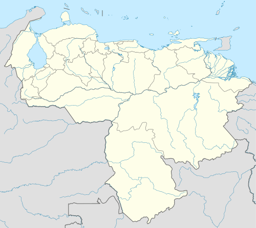
 SVZ Location of airport in Venezuela | |||||||||||
| Runways | |||||||||||
| |||||||||||
Juan Vicente Gómez International Airport (IATA: SVZ, ICAO: SVSA), is an airport serving San Antonio del Táchira, in the Táchira state of Venezuela. In June 1993, it was renamed in honor of the early Venezuelan President Juan Vicente Gómez, who was from Táchira, in a ceremony presided over by interim President Ramón José Velásquez.[3]
The Cucuta VOR-DME (Ident: CUC) is located 7 nautical miles (13 km) northwest of the airport, across the border in Cúcuta, Colombia.[4]
Airlines and destinations
| Airlines | Destinations |
|---|---|
| Rutaca | Caracas |
| Venezolana | Caracas |
See also
 Venezuela portal
 Aviation portal
- Transport in Venezuela
- List of airports in Venezuela
References
- ↑ Airport information for SVZ at Great Circle Mapper.
- ↑ Google Maps - San Antonio del Táchira
- ↑ Ellner, Steve (1995), "Venezuelan Revisionist Political History, 1908-1958: New Motives and Criteria for Analyzing the Past", Latin American Research Review, Vol. 30, No. 2, pp. 91-121. p100
- ↑ CUC VOR
External links
- Airport information for SVSA at World Aero Data. Data current as of October 2006.
- OurAirports - San Antonio Del Tachira Airport
- San Antonio Del Tachira
- OpenStreetMap - Juan Vicente Gómez Airport
This article is issued from Wikipedia - version of the 12/5/2016. The text is available under the Creative Commons Attribution/Share Alike but additional terms may apply for the media files.