Jaisalmer Fort
| Jaisalmer Fort | |
|---|---|
| Jaisalmer Quilla or Sonar Quila | |
| Part of Jaisalmer State Rajputana | |
| Jaisalmer district, Rajasthan | |
|
Jaisalmer Fort panorama | |
 Jaisalmer Fort | |
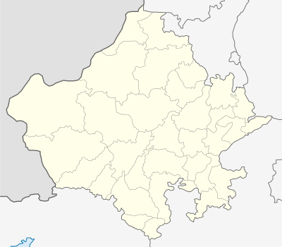
| Coordinates | 26°54′46″N 70°54′45″E / 26.9127°N 70.9126°E |
| Type | Desert Fortification |
| Site information | |
| Controlled by | Jaisalmer State |
| Open to the public | Yes |
| Condition | Protected Monument |
| Site history | |
| Built | 1156 AD |
| Built by | Rawal Jaisal, |
| Garrison information | |
| Occupants | About a quarter of Jaisalmer's population |
| Type | Cultural |
| Criteria | ii, iii |
| Designated | 2013 (36th session) |
| Part of | Hill Forts of Rajasthan |
| Reference no. | 247 |
| State Party | India |
| Region | South Asia |
Jaisalmer Fort is one of the largest fully preserved fortified cities in the world. It is situated in the city of Jaisalmer, in the Indian state of Rajasthan. It is a World Heritage Site. It was built in 1156 AD by the Rajput ruler Rawal Jaisal, from whom it derives its name. The fort stands amidst the sandy expanse of the great Thar Desert, on Trikuta Hill. Before the days of the British Raj, the fortress city served as a refuge and way-station for caravans and travelers along the Silk Road. It's ramparts served as the backdrop for many battles in past centuries when the Silk Road still served as one of the main trade routes between East and West.
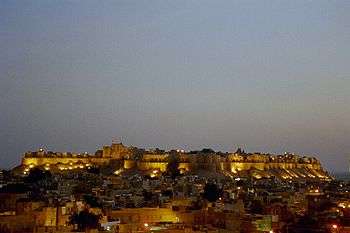
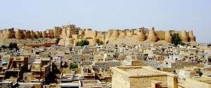
The fort's massive yellow sandstone walls are a tawny lion colour during the day, fading to honey-gold as the sun sets, thereby camouflaging the fort in the yellow desert. For this reason, it is also known as the Sonar Quila or Golden Fort.[1] The fort is located along the southern edge of the city that bears its name, and is perhaps one of the more striking monuments in the area, its dominant hilltop location making the sprawling towers of its fortifications visible for many miles around.[2]
In 2013, at the 37th session of the World Heritage Committee held in Phnom Penh, Cambodia, Jaisalmer Fort, along with 5 other forts of Rajasthan, was declared a UNESCO World Heritage Site under the group Hill Forts of Rajasthan.
History

The fort was built by Rawal Jaisal in 1156 CE. Jaisal conspired with the Sultan of Gaur to dispose his nephew Bhojdev from his territory. The other important event of the fort was during 1276 when King Jetsi strengthened the fort against the invading Sultan of Delhi. The 56 bastions were manned by 3,700 soldiers. After eight years of invasion and siege, the Sultan's army finally breached and destroyed the castle. Bhatis took control of the fort, but had no means to repair it. In 1306, Dodoo was elected the Rawal for his bravery for ejecting the Rathors. He subsequently took up the work of repairing and strenghening the fort.
During the medieval period, the city's location along the Silk Road enabled it to serve as a major center of international trade, and as a warehousing facility for such trade. As such, it facilitated trade and commerce between Persia, Arabia, Egypt, Africa and China. The offering of such services for such commerce required a dependable means of security, and thus the fort came into being.
The fort contains 3 layers of walls. The outer or the lower layer is made out of solid stone blocks and it reinforces the loose rubble of Trikuta Hill. The second, or middle, wall snakes around the fort. From the innermost, or third, wall, the Rajput warriors once hurled boiling oil and water as well as massive blocks of rock at their enemies, who would become entrapped between the second and third walls. The defences of the fort include 99 bastions, of which 92 were built between the period of 1633-47.
Ala-ud-din Khilji attacked and captured the fort in the 13th century and managed to hold it for 9 years. During the siege of the fort the Rajput women committed Jauhar. The second battle at the fort began in 1541, when Mughal emperor Humayun first attacked the fort city. The Rawal was eventually overwhelmed by the repeated assaults of the Mughal emperors and finally agreed to parly with Akbar, Humayan's successor, in 1570, offering his daughter in marriage to the emperor in the process.[3]
The fort remained under the control of Mughals until 1762 when Maharawal Mulraj took control of the fort. Due to its isolated location, the fort escaped the ravages of the Marathas. The treaty between the East India Company and Mulraj on 12 December 1818 allowed the Mulraj to retain control of the fort and provided for protection from invasion. After the death of Mulraj in 1820, his grandson Gaj Singh assumed the reins of the fort.[3]
With the advent of British rule, the emergence of maritime trade and the growth of the port of Bombay led to the gradual economic decline of Jaisalmer. After independence and the Partition of India, the ancient trade route was totally closed, thus sealing the fate of the city. Nonetheless, the continued strategic importance of Jaisalmer was demonstrated during the 1965 and 1971 wars between India and Pakistan Although at one point the entire population of Jaisalmer lived within the fort, it today has a resident population of about 4,000 people who are largely from the Brahmin and Daroga communities. They are mostly descendants of the workforce of the Bhati rulers of Jaisalmer which was permitted to reside within the fort's premises.[2] With an increase in population, people gradually relocated to the foot of the Trikuta Hill and the town of Jaisalmer spread out from the fort.
Architecture
The fort is 1,500 ft (460 m) long and 750 ft (230 m) wide and is built on a hill that raises above a height of 250 ft (76 m) above the surrounding country side. The basement of the fort has a 15 ft (4.6 m) tall wall forming a double line of defence. The bastions of the fort forms a chain about 30 ft (9.1 m). The fort has four entrances to the townside, one of which used to be guarded by cannon.[3]
- Raj Mahal (Royal palace)
- Jain Temples[4]
- Laxminath temple
- 4 massive gateways
- Merchant Havelis. These are large houses often built by wealthy merchants in Rajasthani towns and cities in North India, with ornate sandstone carvings. Some havelis are many hundreds of years old. In Jaisalmer there are many elaborate havelis carved from yellow sandstone. Some of these have many floors and countless rooms, with decorated windows, archways, doors and balconies. Some havelis are today museums but most in Jaisalmer are still lived in by the families that built them. Among these is the Vyas haveli which was built in the 15th century, which is still occupied by the descendants of the original builders. Another example is the Shree Nath Palace which was once inhabited by the prime minister of Jaisalmer. Some of the doors and ceilings are notable examples of old carved wood from many hundreds of years ago.
The fort has an ingenious drainage system called the ghut nali which allows for the easy drainage of rainwater away from the fort in all four directions of the fort. Over the years, haphazard construction activities and building of new roads has greatly reduced its effectiveness.[2]
Culture
The fort has numerous eateries, including Italian, French and native cuisines. The famous Indian film director Satyajit Ray wrote the Sonar Kella (The Golden Fortress), a detective novel, based on the fort and he later filmed it here. The film became a classic and a large number of tourists from Bengal and around the world visit the fort annually to experience for themselves the world that Ray portrayed in the movie.[2] Six forts of Rajasthan, namely, Amber Fort, Chittorgarh Fort, Gagron Fort, Jaisalmer Fort, Kumbhalgarh and Ranthambore Fort were included in the UNESCO World Heritage Site list during the 37th meeting of the World Heritage Committee in Phnom Penh during June 2013. They were recognized as a serial cultural property and examples of Rajput military hill architecture.[5][6]
Restoration
The Jaisalmer Fort today faces manifold threats that are a result of the increasing population pressure on it. Water seepage, inadequate civic amenities, derelict houses and seismic activity around the Trikuta Hill are some of the major concerns impacting the Fort. Unlike most other forts, the Jaisalmer Fort has been built over a weak sedimentary rock foothill which makes its foundations especially vulnerable to seepage. Over the years this has led to the collapse of significant portions of the Fort such as the Queen’s Palace or Rani Ka Mahal and parts of the outer boundary wall and the lower pitching walls.[2]
The World Monuments Fund included the Fort in its 1996 World Monuments Watch and again in the 1998 and 2000 reports due to the threats posed to it by an increase in its resident population and the increasing numbers of tourists who visit it every year.[7] The Fort is one of Rajasthan's most popular tourist attractions with as many as five to six hundred thousand tourists visiting it annually. As a result, it is abuzz with commercial activities and has seen a phenomenal growth in both human and vehicular traffic.[2]
Major restoration work has been undertaken by the World Monuments Fund and UK based charity Jaisalmer in Jeopardy. According to former INTACH chairman S.K. Misra, American Express has provided more than $1 million for the conservation of Jaisalmer Fort.[8] The absence of coordinated action among the various government departments responsible for civic amenities, the local municipality and the Archaeological Survey that is responsible for the upkeep of the fort is a major impediment in its maintenance and restoration.[2]
References
- ↑ "The Fantastic 5 Forts: Rajasthan Is Home to Some Beautiful Forts, Here Are Some Must-See Heritage Structures". DNA : Daily News & Analysis. 28 January 2014. Retrieved 5 July 2015 – via High Beam. (subscription required (help)).
- 1 2 3 4 5 6 7 Sharma, Abha (23 September 2012). "Desert's sinking fort". The Hindu. Retrieved 4 July 2015.
- 1 2 3 Verma, Amrit. Forts of India. New Delhi: The Director, Publication Division, Ministry of Information and Broadcasting, Government of India. pp. 21–23. ISBN 81-230-1002-8.
- ↑ http://www.jaisalmer.org.uk/tourist-attractions/jain-temples.html
- ↑ "Heritage Status for Forts". Eastern Eye. 28 June 2013. Retrieved 5 July 2015 – via High Beam. (subscription required (help)).
- ↑ "Iconic Hill Forts on UN Heritage List". New Delhi, India: Mail Today. 22 June 2013. Retrieved 5 July 2015 – via High Beam. (subscription required (help)).
- ↑ World Monuments Fund - Jaisalmer Fort
- ↑ Misra, S.K. (7 April 2010). "INTACH has earned its position". Indian Express. Retrieved 4 July 2015.
Further reading
- Crump, Vivien; Toh, Irene (1996). Rajasthan (hardback). London: Everyman Guides. p. 400. ISBN 1-85715-887-3.
- Michell, George, Martinelli, Antonio (2005). The Palaces of Rajasthan. London: Frances Lincoln. p. 271 pages. ISBN 978-0-7112-2505-3.
- Tillotson, G.H.R (1987). The Rajput Palaces - The Development of an Architectural Style (Hardback) (First ed.). New Haven and London: Yale University Press. p. 224 pages. ISBN 0-300-03738-4.
External links
- "Jewel of India: Saving Jaisalmer, Realm of the Rajput Princes," ICON Magazine, Spring 2003, p. 22-25.
- World Monuments Fund, Jaisalmer Fort: Third Technical Mission, Identification of a Pilot Project, New York, NY: 2000.
- World Monuments Fund, Restoration of Jaisalmer Fort: Assessment of Outer Fort Walls, New York, NY: 2000.
