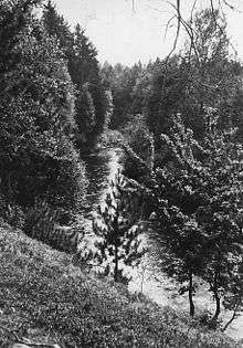
Indian River (Manistique River)
| Indian River | |
|---|---|
 | |
| Country | United States |
| Basin | |
| Main source | Au Train Township, Alger County, Michigan |
| River mouth |
Manistique River near Manistique, Schoolcraft County, Michigan 600 feet (180 m)[1] |
Indian River is a 59.1-mile-long (95.1 km)[2] tributary of the Manistique River on the Upper Peninsula of Michigan in the United States. It rises out of Hovey Lake at 46°17′36″N 86°42′20″W / 46.29333°N 86.70556°W[3] on Hiawatha National Forest land in Alger County and flows south and east through a lake district and on through Schoolcraft County. The river flows into the 8,659 acre (35 km²) Indian Lake at 46°17′36″N 86°42′20″W / 46.29333°N 86.70556°W and flows out at 45°59′30″N 86°17′15″W / 45.99167°N 86.28750°W. It then flows east and south about 2.5 miles where it merges with the Manistique River, which then flows through Manistique and into Lake Michigan at 45°56′56″N 86°14′45″W / 45.94889°N 86.24583°W.[1]
Major tributaries include the Little Indian River, Murphy Creek, Big Murphy Creek, and Smith Creek.
The Indian River is a National Wild and Scenic River, with 12 miles (19 km) designated "Scenic" and 39 miles (63 km) designated "Recreational". This river is popular with paddlers although the section from Hovey Lake to Doe Lake is not maintained for canoes or kayaks and requires a lot of portages. From Doe Lake to Indian Lake is periodically maintained for clear passage by the forest service, but portages may still be required due to the abundance of dead-falls.
References
- 1 2 U.S. Geological Survey Geographic Names Information System: Lower Indian River
- ↑ U.S. Geological Survey. National Hydrography Dataset high-resolution flowline data. The National Map Archived 2012-04-05 at WebCite, accessed December 19, 2011
- ↑ U.S. Geological Survey Geographic Names Information System: Upper Indian River
External links
| Wikimedia Commons has media related to Indian River (Manistique River). |