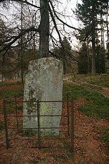
Hunter's Hill Stone

The Hunter's Hill Stone, otherwise known as the Glamis 1 Stone, is a Class II Pictish standing stone at Hunter's Hill to the south east of Glamis village, Angus, Scotland.
Location
The cross slab is located in woodland on the north slope of Hunter's Hill, to the south east of Glamis village, immediately south of the A94 road (grid reference NO39374654).[1]
Description
The stone, a cross-slab, is 1.52 metres (5 ft 0 in) high, 0.71 metres (2 ft 4 in) wide.[2] The slab is carved on the cross face in relief, and the rear face bears incised symbols. It falls into John Romilly Allen and Joseph Anderson's classification system as a class II stone.[3][4]
Relationship with other stones
The Hunter's Hill stone belongs to the Aberlemno School of Pictish sculpture as extended by Laing from Ross Trench Jellicoe's original proposed list. In addition to the Glamis manse stone, stones in the Aberlemno School include Aberlemno 2 (the Kirkyard Stone), Aberlemno 3, Menmuir 1, Kirriemuir 1, Monifieth 2, Eassie, Rossie Priory, and the Glamis Manse Stone (Glamis 2).[5][6]
See also
- Glamis Manse Stone (Glamis 2)
References
- ↑ "Dundee and Montrose, Forfar and Arbroath", Ordnance Survey Landranger Map (B2 ed.), 2007, ISBN 0-319-22980-7
- ↑ "Site record for Hunters Hill, Thornton Standing Stone", Royal Commission on the Ancient and Historical Monuments of Scotland, Canmore Database, retrieved December 2, 2010
- ↑ Allen, J. Romilly; Anderson, J. (1903), Early Christian Monuments of Scotland, 1, Balgavies, Angus: Pinkfoot Press (1993 facsimile), p. 221
- ↑ Allen, J. Romilly (1890), "Preliminary list of sculptured stones older than A.D. 1100, with symbols and Celtic ornament, in Scotland" (PDF), Proceedings of the Society of Antiquaries of Scotland, 24: 510–525, retrieved November 29, 2010
- ↑ Trench-Jellicoe, Ross (1999), "A missing figure on slab fragment no 2 from Monifieth, Angus, the a'Chill Cross, Canna, and some implications of the development of a variant form of the Virgin's hairsyle and dress in early medieval Scotland" (PDF), Proceedings of the Society of Antiquaries of Scotland, 129: 597–647, retrieved November 29, 2010
- ↑ Laing, Lloyd (2001), "The date and context of the Glamis, Angus, carved Pictish stones" (PDF), Proceedings of the Society of Antiquaries of Scotland, 131: 223–239, retrieved November 29, 2010
Coordinates: 56°36′24″N 2°59′21″W / 56.6068°N 2.9893°W