Horace Mann School Historic District
|
Horace Mann School Historic District | |
 | |
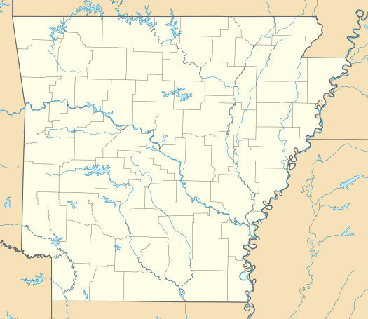  | |
| Location | City Hall Circle, Norfork, Arkansas |
|---|---|
| Coordinates | 36°12′19″N 92°17′2″W / 36.20528°N 92.28389°WCoordinates: 36°12′19″N 92°17′2″W / 36.20528°N 92.28389°W |
| Area | 2 acres (0.81 ha) |
| Built | 1936 |
| Architectural style | Bungalow/craftsman |
| MPS | New Deal Recovery Efforts in Arkansas MPS |
| NRHP Reference # | 06001311[1] |
| Added to NRHP | January 29, 2007 |
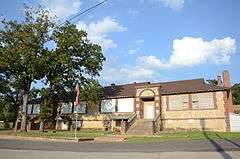
The Horace Mann School Historic District of Norfork, Arkansas encompasses a complex of four Depression-era school buildings near the center of the community. It includes a main school building, built with Works Progress Administration (WPA) funding in 1936, a home economics building and a vocational educational building, both built in 1937 by the National Youth Administration, and the auditorium/gymnasium, built in 1940 with WPA funds. All are single-story Craftsman-style buildings, although the gymnasium presents more stories because of a partially exposed basement. The complex was used as a school until the mid-1980s, and is now owned by the city, which uses the buildings for a variety of purposes. It is a well-preserved and remarkably complete Depression-era school complex.[2]
The complex was listed on the National Register of Historic Places in 2007.[1]
See also
References
- 1 2 National Park Service (2010-07-09). "National Register Information System". National Register of Historic Places. National Park Service.
- ↑ "NRHP nomination for Horace Mann School Historic District" (PDF). Arkansas Preservation. Retrieved 2015-01-16.
| Wikimedia Commons has media related to Horace Mann School Historic District. |
| Topics | |
|---|---|
| Lists by states |
|
| Lists by insular areas | |
| Lists by associated states | |
| Other areas | |
| |