Hillsborough Parish, New Brunswick
| Hillsborough | |
|---|---|
| Parish | |
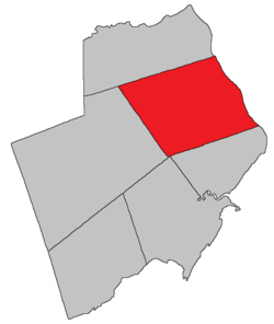 Location within Albert County. | |
| Coordinates: 45°55′N 64°42′W / 45.92°N 64.70°WCoordinates: 45°55′N 64°42′W / 45.92°N 64.70°W | |
| Country |
|
| Province |
|
| County | Albert County |
| Established | 1786 |
| Area[1] | |
| • Land | 303.73 km2 (117.27 sq mi) |
| Population (2011)[1] | |
| • Total | 1,395 |
| • Density | 4.6/km2 (12/sq mi) |
| • Pop 2006-2011 |
|
| • Dwellings | 630 |
| Time zone | AST (UTC-4) |
| • Summer (DST) | ADT (UTC-3) |
Hillsborough is a Canadian parish in Albert County, New Brunswick.[2]
Delineation
Hillsborough Parish is defined in the Territorial Division Act[3] as being bounded:
- South and west by the south line of lot numbered seventeen, granted to William Carlisle and its prolongation westerly to the distance of twelve miles from The Petitcodiac River; thence by a line running north twenty degrees west by the magnet of the year one thousand seven hundred and sixty-five to Coverdale Parish; north by Coverdale Parish; and east by the Petitcodiac River.
History
Albert County: established as a Nova Scotian township in 1765 and became part of New Brunswick as the Parish of Hillsborough (Westmorland County) in 1786: named for Wills Hill (1718-1793), Earl of Hillsborough and the lord commissioner of trade and plantations: Hillsborough Parish included Coverdale Parish until 1828
Located on W side of the Petitcodiac River, 2.26 km NW of Surrey: Hillsborough Parish, Albert County: formerly called German Village for Henry Steeves and a group of German settlers who arrived in 1765 from Pennsylvania: renamed with the creation of the post office: PO Hillsborough from 1840: in 1866 Hillsborough was a community with approximately 167 families: Richard E. Steeves was postmaster and David Wallace was a mill owner: the Albert Mining Company was located nearby: in 1871 Hillsborough had a population of 900: in 1898 Hillsborough was a seaport, a port of entry and a settlement on the Salisbury and Hillsborough Railway with 1 post office, 8 stores, 2 hotels, 1 tannery, 1 carriage factory, nearby gypsum mines and a population of 700: Hillsborough was incorporated as a village in 1966[4]
Communities
Parish population total does not include incorporated municipalities (in bold).
|
|
|
Bodies of water & Islands
This is a list of rivers, lakes, streams, creeks, marshes and Islands that are at least partially in this parish
- Petitcodiac River
- Grays Island
- Stoney Creek
Demographics
Population
LanguageMother tongue language (2006)[6]
| |||||||||||||||||||||||||||||||||||||||
Access Routes
Highways and numbered routes that run through the parish, including external routes that start or finish at the parish limits:[7]
See also
References
- 1 2 2011 Statistics Canada Census Profile: Hillsborough Parish, New Brunswick
- ↑ New Brunswick Provincial Archives - Hillsborough Parish
- ↑ "Territorial Division Act (R.S.N.B. 1973, c. T-3)". Government of New Brunswick website. Retrieved 23 August 2016.
- ↑ New Brunswick Provincial Archives, Government of New Brunswick.
- ↑ Statistics Canada: 2001, 2006 census
- ↑ Profile: Hillsborough Parish, New Brunswick
- ↑ Atlantic Canada Back Road Atlas ISBN 978-1-55368-618-7
 |
Havelock Parish | Coverdale Parish | | |
| Elgin Parish | |
Petitcodiac River Dorchester Parish (Westmorland County) | ||
| ||||
| | ||||
| Harvey Parish | Hopewell Parish |
| Subdivisions | |
|---|---|
| Cities | |
| Counties | |
| |