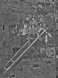
Grissom Aeroplex
| Grissom Aeroplex Grissom Air Reserve Base | |||||||||||
|---|---|---|---|---|---|---|---|---|---|---|---|
|
USGS aerial image - 24 March 1998 | |||||||||||
| IATA: GUS – ICAO: KGUS – FAA LID: GUS | |||||||||||
| Summary | |||||||||||
| Airport type | Public / Military | ||||||||||
| Owner | Miami County Economic Development Authority | ||||||||||
| Operator | Montgomery Aviation | ||||||||||
| Location | Peru, Indiana | ||||||||||
| Elevation AMSL | 812 ft / 247 m | ||||||||||
| Coordinates | 40°38′53″N 086°09′08″W / 40.64806°N 86.15222°W | ||||||||||
| Website | MiamiCountyEDA.com | ||||||||||
| Runways | |||||||||||
| |||||||||||
Grissom Aeroplex (IATA: GUS, ICAO: KGUS, FAA LID: GUS) is a public/military airport in Miami and Cass counties, near Peru, Indiana. The airport is also located 11 miles (18 km) north of city of Kokomo. It is the civil redevelopment of the former Grissom Air Force Base, which was realigned as part of the 1991 Base Realignment and Closure Commission process.
Grissom Aeroplex consists of 850+ acres and existing buildings under control of Miami County Economic Development Authority. It opened as a general aviation airport since 1 March 2008 with no commercial airline service scheduled. Montgomery Aviation serves as the fixed-base operator for the civilian airport operations. [2] [3]
Facilities
Grissom has one runway designated 5/23 with an asphalt surface measuring 12,501 by 200 feet (3,810 x 61 m).[1]
References
- 1 2 FAA Airport Master Record for GUS (Form 5010 PDF). Federal Aviation Administration. Effective 30 June 2011.
- ↑ "About Grissom Aeroplex". Miami County Economic Development Authority.
- ↑ de la Bastide, Ken (13 February 2008). "Grissom now a general aviation airport: Facility will offer civilian operations effective March 1". Kokomo Tribune.
External links
- Montgomery Aviation at Grissom Aeroplex
- FAA Airport Diagram for Grissom ARB (PDF), effective November 10, 2016
- FAA Terminal Procedures for Grissom ARB, effective November 10, 2016
- Resources for this airport:
- FAA airport information for GUS
- AirNav airport information for KGUS
- ASN accident history for GUS
- FlightAware airport information and live flight tracker
- NOAA/NWS latest weather observations
- SkyVector aeronautical chart, Terminal Procedures
