Grade II* listed buildings in Erewash

There are over 20,000 Grade II* listed buildings in England. This page is a list of these buildings in the district of Erewash in Derbyshire.

List of buildings

Name Location Type Completed [note 1]Date designated Grid ref.[note 2]
Geo-coordinates
Entry number [note 3]Image
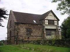
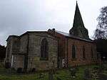
The Old Hall Breadsall House 16th century 10 November 1967 SK3707539828
52°57′16″N 1°26′59″W / 52.954553°N 1.449592°W / 52.954553; -1.449592 (The Old Hall)
1141230
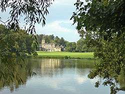
Locko Park Dale Abbey Country house 1669 2 September 1952 SK4096738648
52°56′37″N 1°23′31″W / 52.943664°N 1.391813°W / 52.943664; -1.391813 (Locko Park)
1140431
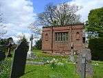
Mausoleum west of Saint Matthews Church Morley Mausoleum 1897 6 November 1986 SK3962940938
52°57′52″N 1°24′41″W / 52.964349°N 1.411443°W / 52.964349; -1.411443 (Mausoleum west of Saint Matthews Church)
1205888
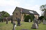
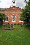
The Recreation Room, Tithe Barn and Dovecote Morley House 16th century 2 September 1952 SK3967540956
52°57′52″N 1°24′39″W / 52.964507°N 1.410756°W / 52.964507; -1.410756 (The Recreation Room, Tithe Barn and Dovecote)
1140415
Church of All Saints Ockbrook Church Late 12th century 10 November 1967 SK4237035702
52°55′01″N 1°22′17″W / 52.917075°N 1.371319°W / 52.917075; -1.371319 (Church of All Saints)
1087941
The Moravian Chapel/church Ockbrook Church 1751 10 November 1967 SK4213836176
52°55′17″N 1°22′29″W / 52.921354°N 1.374708°W / 52.921354; -1.374708 (The Moravian Chapel/church)
1204382
The Moravian Manse Ockbrook House c.1800 10 November 1967 SK4212636169
52°55′17″N 1°22′30″W / 52.921292°N 1.374888°W / 52.921292; -1.374888 (The Moravian Manse)
1204379
Balustrades, gateway and bridge on terrace to south east of Risley Hall Risley Balustrade Early 17th century 10 November 1967 SK4607735536
52°54′55″N 1°18′58″W / 52.915278°N 1.316217°W / 52.915278; -1.316217 (Balustrades, gateway and bridge on terrace to south east of Risley Hall)
1087914
Church of All Saints Risley Church 1593 10 November 1967 SK4610535701
52°55′00″N 1°18′57″W / 52.916759°N 1.315777°W / 52.916759; -1.315777 (Church of All Saints)
1334829
Latin College and the Latin Cottage Risley House 1720 2 September 1952 SK4616135692
52°55′00″N 1°18′54″W / 52.916673°N 1.314945°W / 52.916673; -1.314945 (Latin College and the Latin Cottage)
1087956
Latin House Risley House 1706 2 September 1952 SK4612935679
52°55′00″N 1°18′56″W / 52.916559°N 1.315423°W / 52.916559; -1.315423 (Latin House)
1087955
The Old School House Risley House c.1720 2 September 1952 SK4616835714
52°55′01″N 1°18′53″W / 52.916871°N 1.314838°W / 52.916871; -1.314838 (The Old School House)
1204445
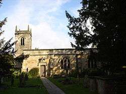
Church of St Michael and All Angels Stanton by Dale Church Early 14th century 10 November 1967 SK4648238143
52°56′19″N 1°18′35″W / 52.938677°N 1.309822°W / 52.938677; -1.309822 (Church of St Michael and All Angels)
1206037
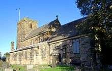
Church of St Wilfrid West Hallam Church 15th century 10 November 1967 SK4321841116
52°57′56″N 1°21′29″W / 52.965672°N 1.357989°W / 52.965672; -1.357989 (Church of St Wilfrid)
1140423
Bennerley Viaduct Ilkeston Railway viaduct 1878–79 21 November 1974 SK4722143809
52°59′22″N 1°17′53″W / 52.989542°N 1.298002°W / 52.989542; -1.298002 (Bennerley Viaduct)
1140437
Church of St Laurence and St James Long Eaton Church 12th century 22 October 1962 SK4915833736
52°53′56″N 1°16′14″W / 52.898827°N 1.270673°W / 52.898827; -1.270673 (Church of St Laurence and St James)
1204249
Church of St Mary Ilkeston Church Early 13th century 26 September 1963 SK4654941739
52°58′16″N 1°18′30″W / 52.970994°N 1.30831°W / 52.970994; -1.30831 (Church of St Mary)
1205669
Ormiston Ilkeston Enterprise Academy Ilkeston School 1910–14 6 November 1986 SK4604441827
52°58′19″N 1°18′57″W / 52.971829°N 1.315816°W / 52.971829; -1.315816 (Ormiston Ilkeston Enterprise Academy)
1329206
Scala Cinema Ilkeston Cinema 1913 6 November 1986 SK4643941782
52°58′17″N 1°18′36″W / 52.97139°N 1.309941°W / 52.97139; -1.309941 (Scala Cinema)
1205711
The Hall Long Eaton House 1778 22 October 1962 SK4905233917
52°54′02″N 1°16′20″W / 52.900463°N 1.272222°W / 52.900463; -1.272222 (The Hall)
1204191

See also

Notes

  1. The date given is the date used by Historic England as significant for the initial building or that of an important part in the structure's description.
  2. Sometimes known as OSGB36, the grid reference is based on the British national grid reference system used by the Ordnance Survey.
  3. The "List Entry Number" is a unique number assigned to each listed building and scheduled monument by Historic England.

Media related to Grade II* listed buildings in Derbyshire at Wikimedia Commons

This article is issued from Wikipedia - version of the 12/2/2016. The text is available under the Creative Commons Attribution/Share Alike but additional terms may apply for the media files.