Gagnoa
| Gagnoa | |
|---|---|
| City, sub-prefecture, and commune | |
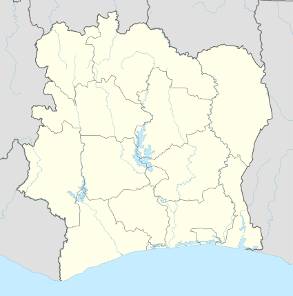
 Gagnoa Location in Ivory Coast | |
| Coordinates: 6°8′N 5°56′W / 6.133°N 5.933°WCoordinates: 6°8′N 5°56′W / 6.133°N 5.933°W[1] | |
| Country | Ivory Coast |
| District | Gôh-Djiboua District |
| Region | Gôh |
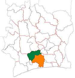
| Department | Gagnoa |
| Population (2014) | |
| • Total | 213,918 |
| [2] | |
| Time zone | GMT (UTC+0) |
Gagnoa is a city in south-central Ivory Coast. It is the seat of both Gôh-Djiboua District and Gôh Region. It is also the seat of and a sub-prefecture of Gagnoa Department. Gagnoa is also a commune. In the 2014 census, its population was 213,918, making it the seventh-largest city in the country.
Gagnoa is the seat of the Roman Catholic Archdiocese of Gagnoa, and contains its cathedral.
Climate
| Climate data for Gagnoa | |||||||||||||
|---|---|---|---|---|---|---|---|---|---|---|---|---|---|
| Month | Jan | Feb | Mar | Apr | May | Jun | Jul | Aug | Sep | Oct | Nov | Dec | Year |
| Average high °C (°F) | 32.3 (90.1) |
33.6 (92.5) |
33.0 (91.4) |
32.5 (90.5) |
31.6 (88.9) |
29.8 (85.6) |
28.6 (83.5) |
28.6 (83.5) |
29.8 (85.6) |
30.9 (87.6) |
31.1 (88) |
30.7 (87.3) |
31.0 (87.8) |
| Daily mean °C (°F) | 26.1 (79) |
26.8 (80.2) |
27.5 (81.5) |
27.3 (81.1) |
26.8 (80.2) |
25.7 (78.3) |
24.9 (76.8) |
24.7 (76.5) |
25.5 (77.9) |
26.2 (79.2) |
26.5 (79.7) |
25.7 (78.3) |
26.1 (79) |
| Average low °C (°F) | 20.1 (68.2) |
21.8 (71.2) |
22.2 (72) |
22.3 (72.1) |
22.3 (72.1) |
21.9 (71.4) |
21.4 (70.5) |
21.4 (70.5) |
21.7 (71.1) |
22.0 (71.6) |
22.0 (71.6) |
20.9 (69.6) |
21.7 (71.1) |
| Average precipitation mm (inches) | 23.5 (0.925) |
63.4 (2.496) |
123.1 (4.846) |
162.8 (6.409) |
177.5 (6.988) |
205.8 (8.102) |
89.4 (3.52) |
95.4 (3.756) |
172.0 (6.772) |
159.2 (6.268) |
96.4 (3.795) |
37.5 (1.476) |
1,406 (55.354) |
| Mean monthly sunshine hours | 195.7 | 184.5 | 189.0 | 204.9 | 210.4 | 122.0 | 120.8 | 97.5 | 127.1 | 176.4 | 180.2 | 166.0 | 1,974.5 |
| Source: NOAA[3] | |||||||||||||
References
- ↑ "Ivory Coast Cities Longitude & Latitude". sphereinfo.com. Retrieved 19 November 2010.
- ↑ "Côte d'Ivoire". geohive.com. Retrieved 5 December 2015.
- ↑ "Gagnoa Climate Normals 1961–1990". National Oceanic and Atmospheric Administration. Retrieved December 21, 2015.
| | |||||||||
|---|---|---|---|---|---|---|---|---|---|
| Rank | Name | District | Pop. | ||||||
| Abidjan |
1 | Abidjan | Abidjan | 4 395 243 | |||||
| 2 | Bouaké | Vallée du Bandama | 536 189 | ||||||
| 3 | Daloa | Sassandra-Marahoué | 319 427 | ||||||
| 4 | Korhogo | Savanes | 286 071 | ||||||
| 5 | Yamoussoukro | Yamoussoukro | 281 735 | ||||||
| 6 | San-Pédro | Bas-Sassandra | 261 616 | ||||||
| 7 | Gagnoa | Gôh-Djiboua | 213 918 | ||||||
| 8 | Man | Montagnes | 188 704 | ||||||
| 9 | Duékoué | Montagnes | 185 344 | ||||||
| 10 | Divo | Bas-Sassandra | 179 455 | ||||||
This article is issued from Wikipedia - version of the 5/2/2016. The text is available under the Creative Commons Attribution/Share Alike but additional terms may apply for the media files.
