Forst (Unterfranken)
| Forst | ||
|---|---|---|
| Village of Schonungen | ||
| ||
 Forst | ||
| Coordinates: 50°02′22″N 10°19′47″E / 50.03944°N 10.32972°ECoordinates: 50°02′22″N 10°19′47″E / 50.03944°N 10.32972°E | ||
| Country | Germany | |
| State | Bavaria | |
| Admin. region | Lower Franconia | |
| District | Schweinfurt | |
| Town | Schonungen | |
| Area | ||
| • Total | 6.31 km2 (2.44 sq mi) | |
| Population (2007-01-01) | ||
| • Total | 1,013 | |
| • Density | 160/km2 (420/sq mi) | |
| Time zone | CET/CEST (UTC+1/+2) | |
| Postal codes | 97453 | |
| Dialling codes | 09727 | |
| Vehicle registration | SW | |

 Main street of Forst, looking towards church |
Forst in Unterfranken is a little village in the Schonungen township that lies in Schweinfurt county. It has about 1,000 inhabitants.
Location
Forst lies approximately 1/2 mile just north of the Main river along the southern exposed north bank of the Main river valley. At 923 ft (284m) above sea level, it is about 227 ft (70m) above the river. Many new houses have been built, except in the old village center, due to the great view into the valley. The expansion predominantly took place to the west towards Schonungen.
.jpg)
History
The village is first documented in the year 1183. The village was formed as a part of the free imperial city of Schweinfurt which was later given to the Count of Henneberg. During the Margravian War in 1553 and the Thirty Years' War the area suffered heavily.
Objects of Interest
Forst's main landmarks include:
- The old tithe house from the year 1567 and other fachwerk (Tudor-type) houses along the old roads which meet in the village center at the park
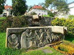
- The war memorial and above it the natural stone spring in the village center park
- St. Godehard catholic church
- Boten-Steig Arena (soccer field) of the Forst sports club
- Part of the old village wall in the rear church courtyard
Events
- Annual
- Knutfest of the Forst sports club
- Karneval of Forst
- Parish fest
- Party-Weekend of the Forst sports club
- Church fest
Economy
- Wheat, rye, oats, rapseed, beets, corn, and asparagus are cultivated in the surrounding fields
- The cherries from Forst are well-known within the region
- Northeast, between Forst and Waldsachsen, are eleven wind turbines which produce 1 or 2.3 megawatts of electricity each
- There are two family-run restaurants and one night club located in town
Traffic
Forst is connected by county road, SW23, to state road B26. Likewise, buslines 8130 (Schweinfurt-Aidhausen) and 8156 (Schweinfurt-Hassfurt) of the Franconia Public Bus Transportation (OVF-Omnibusverkehr Franken) ensure good trafficability in all directions.
Personalities
Sons and Daughters of Forst
- Sebastian König, TV narrator and actor
- Ron Mihalko, Former First Sergeant with the longest one station (Schweinfurt) overseas record, has lived in Forst since 1997.
External links

Wikimedia Commons has media related to Forst. - Information about Forst- In German