Forbidden Plateau

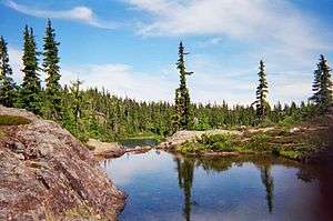
The Forbidden Plateau is a small, hilly plateau in the east of the Vancouver Island Ranges in British Columbia, northwest of Comox Lake[1] roughly between Mount Albert Edward to the southwest and Mount Washington to the northeast. The gently sloping sub-alpine terrain is broken by small, rugged hills and pitted with small lakes. Much of it is contained within Strathcona Provincial Park, and a network of trails facilitate hiking, cross country skiing, and access to Mount Albert Edward. A sub-alpine meadow on Mount Beecher in the southwest corner of the plateau is the only site in Canada of the Olympic onion (Allium crenulatum).[2] It was the epicentre of the 1946 Vancouver Island earthquake that registered 7.3 on the Richter magnitude scale, the strongest ever recorded on land in Canada.[3]
The legend
When the K'omoks faced raids from other coastal tribes, they took their women and children to the plateau for safekeeping. During a raid by the Cowichan, the women and children vanished without a trace. When a member of the tribe went looking for the women and children within the Forbidden Plateau, he found red lichen covering the snow and nearby rocks and assumed the lichen to be blood from the family members. Since then, the plateau became taboo for it was believed that it was inhabited by evil spirits who had consumed those they had sent.[4]
Gallery
See also
Notes and references
- ↑ "Forbidden Plateau". BC Geographical Names.
- ↑ Schaan, Gary. 2004. "Managing Towards the Gold Standard—Ecological Values of Second Growth Small Woodlands on Vancouver Island." In T.W. Droscher and D.A. Fraser (eds). Proceedings of the 2003 Georgia Basin/Puget Sound Research Conference. CD-ROM or Online. Available: http://www.psat.wa.gov/Publications/03_proceedings/start.htm [February 2004]
- ↑ Derek Sidenius (1999-01-24). "Shake, Rattle and Roll in '46 Earthquake". Victoria Times Colonist Islander Magazine. Archived from the original on 2006-09-26. Retrieved 2006-07-14.
- ↑
- Legends from British Columbia Communities The British Columbia Folklore Society. Accessed 6 September 2012.
- More to Nootka Sound than fishing Seattle Times. Accessed 6 September 2012.
- Selling British Columbia: Tourism and Consumer Culture, 1890-1970. Michael Dawson. University of British Columbia Pr (2005).
External links
Coordinates: 49°41′00″N 125°19′00″W / 49.68333°N 125.31667°W


