Flawith

Coordinates: 54°04′56″N 1°15′51″W / 54.082270°N 1.264110°W
Flawith is a village and civil parish in Hambleton district of North Yorkshire, England.[1][2]It is situated approximately 4 miles (6.4 km) south-west of Easingwold. The population taken at the 2011 Census was less than 100. Details are included in the civil parish of Aldwark, North Yorkshire.
The origin of the place-name is not clear. One explanation is that it comes from the Old Norse words flagth and vath meaning ford of the female troll or witch. Alternatively it might come from the Old Norse flatha meaning flat meadow or from the Old English fleathe meaning water-lily. The place-name appears as Flathwayth in c. 1190.[3]
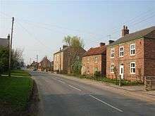
Main street in Flawith
References
- ↑ Ordnance Survey: Landranger map sheet 100 Malton & Pickering (Helmsley & Easingwold) (Map). Ordnance Survey. 2012. ISBN 9780319231203.
- ↑ "Ordnance Survey: 1:50,000 Scale Gazetteer" (csv (download)). www.ordnancesurvey.co.uk. Ordnance Survey. 1 January 2016. Retrieved 18 February 2016.
- ↑ Mills, A.D. (2011) [first published 1991]. A Dictionary of British Place Names (First edition revised 2011 ed.). Oxford: Oxford University Press. p. 190. ISBN 9780199609086.
External links
![]() Media related to Flawith at Wikimedia Commons
Media related to Flawith at Wikimedia Commons
This article is issued from Wikipedia - version of the 2/21/2016. The text is available under the Creative Commons Attribution/Share Alike but additional terms may apply for the media files.