F 2 Hägernäs
| Kungliga Roslagens Flygflottilj | |
|---|---|
 | |
| Active | 1926–1974 |
| Garrison/HQ | Hägernäs, Täby Municipality |
| Commanders | |
| Wing commanders |
Arthur Örnberg (1926–1929) |
| Aircraft flown | |
| Attack | T 1, T 2 |
| Fighter | J 4 |
| Patrol | P 1 |
| Reconnaissance | S 1, S 2, S 3, S 4, S 5, S 9, S 12, S 17 |
| Trainer | G 101, Se 102, Se 103, Se 104, Sk 2, Sk 3, Sk 4, Sk 6, Sk 15, Sk 50B, Ö 2, Ö 7, Ö 9 |
| Transport | Tp 1, Tp 2, Tp 8, Tp 24, Tp 45A, Tp 47, Tp 78 |
F 2 Hägernäs, Roslagens Flygflottilj, Roslagen Air Force Wing, or simply "F 2", is a former Swedish Air Force wing with the main base located on the east coast of Sweden just north of the capital Stockholm.
History of the airbase
From 1919 the area was used for flight training for navy pilots.
The wing started out as the 2'nd Flying Corps in 1926 with seaplanes for naval scouting and reconnaissance and bomb and torpedo attacks. In 1936 the unit was designated F 2 as an Air Force wing.
A squadron of T 2 served between 1939 and 1944 and another squadron of S 12 between 1941 and 1945.
The last operational flying squadron at F 2 consisted of S 17's from 1942 to 1949 when the wing was renamed Roslagens Flygkår, Roslagen Flying Corps. The wing then became home for various other operational units in the Air Force.
The unit became home to the naval rescue unit until it moved to F 8 Barkarby in 1960. From 1948, the Radar School was located at F 2 and in 1959 the GCI-school also joined.
From 1951 to 1962, the Air Force Meteorology School was located here until moving to F 12 Kalmar.
In 1966 the Air Force Academy for ground troops was started at F 2 and remained until 1974 when the wing was decommissioned and all schools were transferred to F 18 Tullinge.
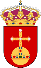
The emblem of Uppland was after decommissioning transferred to F 16 Uppsala.
Current use
The base area was used for general seaplane aviation until converted to a residential area in 2002. One of the hangars remained and was restored as a parking garage.
References
Webpage listing all air force squadrons in Sweden
See also
Coordinates: 59°26′41″N 18°07′31″E / 59.4447°N 18.1253°E