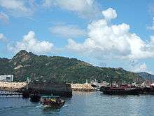
Devil's Peak, Hong Kong


Devil's Peak (Chinese: 魔鬼山) is the peak besides Lei Yue Mun on New Kowloon, Hong Kong. The area around the peak was garrisoned by the British Army or local pirates to control the passage of Lei Yue Mun, which is an important nautical passage in South China. The remains of a redoubt and batteries are still visible on the peak.
Geography
Devil's Peak stands at 222 metres in height. To the east of the peak lies Junk Bay Chinese Permanent Cemetery and Yau Tong lies to its west. The hill extends its ridge south to water in Lei Yue Mun and north to Chiu Keng Wan Shan.
Military history
The major parts of the military sites on Devil's Peak were built between 1900 and 1914. The four main clusters of military structures that remain are:
- Devil's Peak Redoubt, which stands on the summit at a level of 222m. It was built in 1914.
- A small site at 196m
- Gough Battery - upper battery at 160m, was built in 1898 with 2 6-inch guns; one later replaced by 9.2-inch guns; guns removed in 1936 to Stanley Fort
- Pottinger Battery - lower battery at 81m, with 9.2-inch guns; guns removed in 1936 to Bokhara Battery, Cape D'Aguilar
A list of troops whom were stationed here (mainly during World War II):
- 5/7 Rajput Regiment
- 1st Mountain Battery of the Hong Kong and Singapore Royal Artillery
Access
Section 3 of The Wilson Trail begins near Devil's Peak. It is possible to access the fort on foot from the Wilson Trail.
See also
External links
| Wikimedia Commons has media related to Devil's Peak, Hong Kong. |
- Batteries on Devil's Peak
- Lai, Lawrence; Ho, Daniel; Leung, Hing Fung (2002). "Survey of the Devil's Peak redoubt and Gough Battery" (PDF). Journal of the Royal Asiatic Society Hong Kong Branch. Hong Kong. 42: 101–137. ISSN 1991-7295.
- Lai, Lawrence W. C.; Ho, Daniel C.; Yung, P. (2007). "Survey of the Pottinger Battery" (PDF). Journal of the Royal Asiatic Society Hong Kong Branch. Hong Kong. 47: 91–114. ISSN 1991-7295.
- Facilities Management and Planning for Heritage Sites: Lessons Learnt From a Pilot Study on Disused Military Sites
- Fun in Kwun Tong - Devil's Peak Batteries
Coordinates: 22°17′38″N 114°14′38″E / 22.29389°N 114.24389°E