Ch'aska Urqu (Nor Lípez)
For the mountain in the Sur Lípez Province, Potosí Department, Bolivia, see Ch'aska Urqu (Sud Lípez).
| Ch'aska Urqu | |
|---|---|
 Ch'aska Urqu Location in Bolivia | |
| Highest point | |
| Elevation | 4,100 m (13,500 ft) |
| Coordinates | 21°21′52″S 68°9′30″W / 21.36444°S 68.15833°WCoordinates: 21°21′52″S 68°9′30″W / 21.36444°S 68.15833°W |
| Geography | |
| Location | Bolivia, Potosí Department, Nor Lípez Province |
| Parent range | Andes |
Ch'aska Urqu (Quechua ch'aska star; tousled, urqu mountain,[1] "star mountain" or "tousled mountain", also spelled Chasca Orkho) is a mountain in the Andes of Bolivia, about 4,100 metres (13,451 ft) high. It is located in the Potosí Department, Nor Lípez Province, Quemes Municipality, Pelcoya Canton. Ch'aska Urqu lies near the border with Chile, southeast of the Ollagüe (Ullawi) volcano and southwest of Wanaku.[2]
References
- ↑ Teofilo Laime Ajacopa, Diccionario Bilingüe Iskay simipi yuyayk'ancha, La Paz, 2007 (Quechua-Spanish dictionary)
- ↑ "San Pedro de Quemes". Retrieved August 14, 2014.
Capital: Potosí | ||
| Provinces | 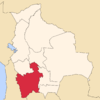 | |
| Municipalities (and seats) |
| |
This article is issued from Wikipedia - version of the 6/10/2016. The text is available under the Creative Commons Attribution/Share Alike but additional terms may apply for the media files.