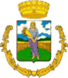
Celenza Valfortore
| Celenza Valfortore | ||
|---|---|---|
| Comune | ||
| Comune di Celenza Valfortore | ||
| ||
 Celenza Valfortore Location of Celenza Valfortore in Italy | ||
| Coordinates: 41°34′N 14°59′E / 41.567°N 14.983°E | ||
| Country | Italy | |
| Region | Apulia | |
| Province / Metropolitan city | Foggia (FG) | |
| Government | ||
| • Mayor | Massimo Venditti | |
| Area | ||
| • Total | 66.49 km2 (25.67 sq mi) | |
| Elevation | 480 m (1,570 ft) | |
| Population (1 July 2009)[1] | ||
| • Total | 1,802 | |
| • Density | 27/km2 (70/sq mi) | |
| Demonym(s) | Celenzani | |
| Time zone | CET (UTC+1) | |
| • Summer (DST) | CEST (UTC+2) | |
| Postal code | 71035 | |
| Dialing code | 0881 | |
| Patron saint | St. John | |
| Saint day | 24 June | |
| Website | Official website | |
Celenza Valfortore is a town and comune in the province of Foggia in the Apulia region of southeast Italy.
Main sights
- Church of Santa Croce
- Porta Nova
- Gambacorta Castle (15th and 16th centuries)
Demographics
The population has been constantly shrinking in recent years. A massive emigration occurred during and after the Second World War. Numerous inhabitants moved to countries such as Argentina, the United States, and Australia.
Economy
Agriculture used to employ the major part of the labour force. Cattle and farming were the main activities, although in the last years this has been changing, with the tertiary sector employing 41 percent of the working force.
Climate
Winters are cold, influenced by the Apennines, with occasional snowfalls taking place between the months of November and March.
Summers are extremely dry and hot. Almost no rainfall occurs between June and August.
References
External links
- Our Celenza Heritage A site dedicated to the descendants of Celenza Valfortore and their immigrant ancestors
- Celenza Valfortore and San Marco la Catola Online (Italian) An Italian language site dedicated to these two neighboring villages, includes pictures, traditions, news, and links
