Castro Peak
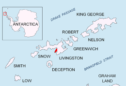
Location of Hurd Peninsula on Livingston Island in the South Shetland Islands.
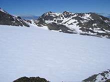
Castro Peak

Topographic map of Livingston Island, Greenwich, Robert, Snow and Smith Islands.
Castro Peak (Bulgarian: връх Кастро, ‘Vrah Castro’ \'vr&h 'ka-stro\) is a peak rising to 306 m on Hurd Peninsula, Livingston Island. Situated 750 m south-southwest of MacGregor Peaks and 1.87 km northeast of Binn Peak. Spanish early mapping in 1991. Named for Vicente Castro, mountain guide at Juan Carlos I Antarctic Base who took part in the first ascent of the peak during the 2003/04 season.
Coordinates: 62°42′19″S 60°23′54″W / 62.70528°S 60.39833°W
Maps
- L.L. Ivanov et al. Antarctica: Livingston Island and Greenwich Island, South Shetland Islands. Scale 1:100000 topographic map. Sofia: Antarctic Place-names Commission of Bulgaria, 2005.
- L.L. Ivanov. Antarctica: Livingston Island and Greenwich, Robert, Snow and Smith Islands. Scale 1:120000 topographic map. Troyan: Manfred Wörner Foundation, 2009.
References
This article includes information from the Antarctic Place-names Commission of Bulgaria which is used with permission.
This article is issued from Wikipedia - version of the 11/21/2015. The text is available under the Creative Commons Attribution/Share Alike but additional terms may apply for the media files.