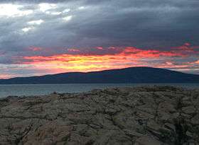
Cadillac Mountain
| Cadillac Mountain | |
|---|---|
 Sunset behind Cadillac Mountain | |
| Highest point | |
| Elevation | 1,527 ft (465 m) NAVD 88[1] |
| Prominence | 1,527 ft (465 m) [1] |
| Coordinates | 44°21′05″N 68°13′35″W / 44.35127°N 68.22649°WCoordinates: 44°21′05″N 68°13′35″W / 44.35127°N 68.22649°W [2] |
| Geography | |
| Location | Hancock County, Maine, U.S. |
| Topo map | USGS Seal Harbor |
| Climbing | |
| Easiest route | Paved road or marked hiking trails |
Cadillac Mountain is located on Mount Desert Island, within Acadia National Park. With an elevation of 1,528 feet (470 m), its summit is the highest point in Hancock County and the highest within 25 miles (40 km) of the shoreline of the North American continent between the Cape Breton Highlands, Nova Scotia and Mexican peaks 180 miles (290 km) south of the Texas border.[3]
History
Before being renamed in 1918, the mountain had been called Green Mountain. The new name honors the French explorer and adventurer Antoine Laumet de La Mothe, sieur de Cadillac. In 1688, De la Mothe requested and received from the Governor of New France a parcel of land in an area known as Donaquec which included part of the Donaquec River (now the Union River) and the island of Mount Desert in the present-day U.S. state of Maine. Antoine Laumet de La Mothe, a shameless self-promoter who had already appropriated the "de la Mothe" portion of his name from a local nobleman in his native Picardy, thereafter referred to himself as Antoine de la Mothe, sieur de Cadillac, Donaquec, and Mount Desert.
From 1883 until 1893 the Green Mountain Cog Railway ran to the summit to take visitors to the Green Mountain Hotel on the summit.[4] The hotel was burned down in 1895. Also in 1895, the cog train was sold and moved to the Mount Washington Cog Railway in New Hampshire.
Overview

There are various hiking trails to the summit of Cadillac Mountain, some more challenging than others. There is also a paved road to the top.
Driving or hiking to the summit of Cadillac Mountain to see "the nation's first sunrise" is a popular activity among visitors of Acadia National Park. However, Cadillac only sees the first sunrise in the fall and winter, when the sun rises south of due east.[5] During most of the spring and summer, the sun rises first on Mars Hill, 150 miles (240 km) to the northeast. For a few weeks around the equinoxes, the sun rises first at West Quoddy Head in Lubec, Maine.
On exceptionally clear days, it is possible to see Mount Katahdin, Maine's highest mountain, to the north and the Canadian province of Nova Scotia to the east, both over one hundred miles away.
Gallery
- The highway to Cadillac Mountain
- The first rays of sun in the United States as seen from Cadillac Mountain
- Sun rising from atop Cadillac
- Sunrise with the Porcupine Islands in the foreground
- The Porcupine Islands at noon
- Sunrise from atop Cadillac
- Sunrise with Dorr Mountain in the foreground, and the Atlantic Ocean in the background
 View of the sunrise from Cadillac Mountain
- View of the Atlantic Ocean from Cadillac Mountain
- Another view from the top of Cadillac Mountain
- Tourists on Cadillac Mountain
- The rocky terrain atop Cadillac Mountain
- Plaque honoring Stephen Mather, first director of the National Park Service
References
- 1 2 "Cadillac Mountain, Maine". Peakbagger.com. Retrieved 2007-12-26.
- ↑ "Cadillac Mountain". Geographic Names Information System. United States Geological Survey.
- ↑ "Cadillac Mountain". U.S. National Park Service. 2004-10-28. Archived from the original on 2007-12-11. Retrieved 2007-12-26.
- ↑ All Aboard for Yesterday! A Nostalgic History of Railroading in Maine. Camden: Down East. 1979. p. 23. ISBN 0-89272-053-0. OCLC 5844214.
- ↑ "Katahdin, Maine". Peakbagger.com. Retrieved 2007-12-26. Analysis by Blanton C. Wiggin, published in the January 1972 issue of Yankee magazine, determined that the first sunrise in the U.S. occurs at Cadillac Mountain from October 7 to March 6.
External links
| Wikimedia Commons has media related to Cadillac Mountain. |
- "Cadillac Mountain". SummitPost.org. Retrieved 2011-05-09.