Burnaston
| Burnaston | |
 Where Etwall Lane meets the road to Mickleover |
|
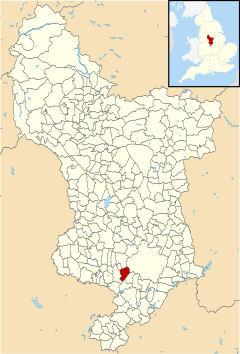
 Burnaston parish highlighted within Derbyshire |
|
| Population | 1,531 (2011) |
|---|---|
| OS grid reference | SK288325 |
| District | South Derbyshire |
| Shire county | Derbyshire |
| Region | East Midlands |
| Country | England |
| Sovereign state | United Kingdom |
| Post town | DERBY |
| Postcode district | DE65 |
| Dialling code | +44 |
| Police | Derbyshire |
| Fire | Derbyshire |
| Ambulance | East Midlands |
| EU Parliament | East Midlands |
|
|
Burnaston is a village and civil parish located in Derbyshire, just south of the city of Derby. The population of the civil parish taken at the 2011 Census was 1,531.[1]
The village is famous for Toyota TMUK – one of several British car plants built by Japanese carmakers, as part of cost–saving measures to avoid expenses, such as import duties and shipping costs. It was established in December 1989, but opened on 16 December 1992.[2]
Burnaston House was demolished to make way for the car factory. The house, which was being restored at the time, was the home of the Every family. This included Ashton Nicholas Every Mosley, who was a high sheriff of Derbyshire.[3] The Toyota site also covers the area formerly occupied by Derby Airport, a small all-grass airfield that was opened in 1938 as Derby's municipal airport. During World War II, it was used for military training purposes.
After the war, it was again used by airlines, including Derby Aviation (later British Midland Airways) until 1965, when the newly reconstructed East Midlands Airport opened. Private flying from Burnaston continued until December 1989, when the site was taken over for car manufacture.[4]
The village has swift and direct road links with nearby cities Derby and Nottingham, as well as the city of Birmingham that is some forty miles southwards along the A38 dual carriageway. It is also within twenty miles of East Midlands Airport. It was also the location of Burnaston College - Junior School for Boys, established 1912.
Notes
- ↑ "Civil Parish population 2011". Neighbourhood Statistics. Office for National Statistics. Retrieved 21 March 2016.
- ↑ "Archived copy". Archived from the original on 2008-01-16. Retrieved 2008-01-16.
- ↑ The London Gazette: no. 19238. pp. 235–236. 9 February 1835. Retrieved 2008-09-21.
- ↑ Marriott, 1993, p. 58
References
- Marriott, Leo (1993). British Airports. Ian Allan Ltd. ISBN 0-7110-2076-0.
External links
![]() Media related to Burnaston at Wikimedia Commons
Coordinates: 52°53′24″N 1°34′23″W / 52.890°N 1.573°W
Media related to Burnaston at Wikimedia Commons
Coordinates: 52°53′24″N 1°34′23″W / 52.890°N 1.573°W