Bletoppen
| Bletoppen | |
|---|---|
 | |
| Highest point | |
| Elevation | 1,342 m (4,403 ft) |
| Coordinates | 59°48′30″N 9°9′11″E / 59.80833°N 9.15306°ECoordinates: 59°48′30″N 9°9′11″E / 59.80833°N 9.15306°E |
| Geography | |
| Location | Tinn, Telemark, Norway |
| Parent range | Blefjell |
| Topo map | 1618 I Tinnsjå |
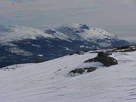
Bletoppen is a mountain in Tinn, Telemark, Norway, and is the highest point in the mountain area Blefjell.
From the summit there is a view to Jonsknuten and Skrimfjella in southeast, Lifjell in southwest, Gaustatoppen in west, and Hardangervidda in north west.
The summit is most easily reached by following a marked trail from the parking lot at Nordstul, 3 to 4 hours hike in the summer. Numerous shorter paths starts at the road to Fosskard and goes up the steep western side of Blefjell.
This article is issued from Wikipedia - version of the 5/11/2013. The text is available under the Creative Commons Attribution/Share Alike but additional terms may apply for the media files.