Balua, Ghazipur
| Balua, Ghazipur Balua - Tapa Shahpur बलुंवा - तप्पेशःपुर | |
|---|---|
| Village | |
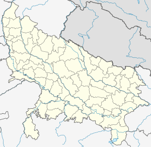 Balua, Ghazipur  Balua, Ghazipur Location in Uttar Pradesh, India | |
| Coordinates: 25°32′28″N 83°51′00″E / 25.541°N 83.850°ECoordinates: 25°32′28″N 83°51′00″E / 25.541°N 83.850°E | |
| Country |
|
| State | Uttar Pradesh |
| District | Ghazipur |
| Talukas | Mohammadabad |
| Government | |
| • Gram Pradhan | Babban Rai |
| Population (2011)[1] | |
| • Total | 1,054 |
| Languages | |
| • Official | Hindi |
| • Other | Bhojpuri, Hindi |
| Time zone | IST (UTC+5:30) |
| PIN | 23 32 31 |
| Telephone code | 0548 |
| Vehicle registration | UP |
| Sex ratio | 1.99 : 1 ♂/♀ |
| Distance from Buxar | 58 kilometres (36 mi) |
| Police Station | Bhanwarkol |
| Post Office | Tarawan |
| Website |
up |
Balua - Tapa Shahpur or commonly known as Balua is a small village located on the north bank of river Ganges, near Birpur in Ghazipur district, Uttar Pradesh. The village is mainly a farmland with a small set of population. It is well connected to the NH 19.
Demographics
Most of the population of the village consists of farmers. The total population is 1054 of which around 702 are males and 352 are females. The principal religion followed is Hinduism as can be seen from very few number of Muslims in the village. A majority of population are scheduled castes, which live in the southern side of the village.
Culture
Temples
The village has numerous temples and a mosque.
References
- ↑ "Population of Village under Mohammadabad Block". Retrieved May 26, 2012.
This article is issued from Wikipedia - version of the 10/2/2016. The text is available under the Creative Commons Attribution/Share Alike but additional terms may apply for the media files.