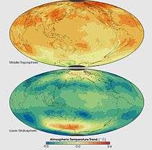
Atmospheric temperature

Atmospheric temperature is a measure of temperature at different levels of the Earth's atmosphere. It is governed by many factors, including incoming solar radiation, humidity and altitude. When discussing surface temperature, the annual atmospheric temperature range at any geographical location depends largely upon the type of biome, as measured by the Köppen climate classification.
Temperature versus height


In the Earth's atmosphere, temperature varies greatly at different heights relative to the Earth's surface. The coldest temperatures lie near the mesopause, an area approximately 85 km (53 mi) to 100 km (62 mi) above the surface. In contrast, some of the warmest temperatures can be found in the thermosphere, which receives strong ionizing radiation at the level of the Van Allen radiation belt.
Temperature varies as one moves vertically upwards from the Earth's Surface.
Global temperature
The concept of a global temperature is commonly used in climatology, and denotes the average temperature of the Earth based on surface,[2] near-surface or tropospheric measurements. These temperature records and measurements are typically acquired using the satellite or ground instrumental temperature measurements, then usually compiled using a database or computer model. Long-term global temperatures in paleoclimate are discerned using proxy data.
See also
References
- ↑ Geometric altitude vs. temperature, pressure, density, and the speed of sound derived from the 1962 U.S. Standard Atmosphere.
- ↑ Hansen, James E. "GISS Surface Temperature Analysis (GISTEMP)". National Aeronautic and Space Administration. Goddard Institute for Space Studies. Retrieved 1 September 2011.