Argo, Saskatchewan
For other possible meanings see Argo (disambiguation)
| Argo | |
|---|---|
| Unincorporated community | |
|
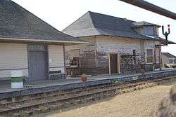
Argo Train Station | |
 Location of [settlement] in Saskatchewan | |
| Coordinates: 52°01′0″N 108°06′0″W / 52.01667°N 108.10000°W | |
| Country | Canada |
| Province | Saskatchewan |
| Rural Municipalities (R.M.) | Biggar No. 347, Saskatchewan |
| Post office Founded | 1917-01-01 |
| [1][2][3][4] | |
Argo is an unincorporated community or a siding administered by the rural municipality of Biggar No. 347, in the Canadian province of Saskatchewan. Argo was located on the Dodsland Branch Canadian National Railway between Biggar and Duperow. The closest town is Biggar to the northeast. Biggar railway station is a divisional point for the Canadian National Railway (CNR).[5][6]
Demographics
The unincorporated area of Argo is enumerated in the rural municipality (RM) of Biggar No. 347, Saskatchewan. The statistics for the RM show a rural population of 867 residents.
| Canada census – Argo, Saskatchewan community profile | |||
|---|---|---|---|
| 2006 | |||
| Population: | 867 (-16.0% from 2001) | ||
| Land area: | 1,597.87 km2 (616.94 sq mi) | ||
| Population density: | 0.5/km2 (1.3/sq mi) | ||
| Median age: | N/A (M: N/A, F: N/A) | ||
| Total private dwellings: | 292 | ||
| Median household income: | $N/A | ||
| References: 2006[7] | |||
- N/A = Data Not Available
Area statistics
- Lat (DMS) 52°01′00″ N
- Long (DMS) 108°06′00″ W
- Dominion Land Survey Section 17-Township 35- Range 15-West of the 3rd Meridian
- Time zone (cst) UTC−6
Location
 |
Palo, Oban Lake, Whiteshore Lake | Oban | Biggar, Saskatchewan | |
| Lydden | |
|||
| ||||
| | ||||
| Bear Hills |
See also
References
- ↑ National Archives, Archivia Net, Post Offices and Postmasters, archived from the original on 2006-10-06
- ↑ Government of Saskatchewan, MRD Home, Municipal Directory System, archived from the original on 2008-03-14
- ↑ Canadian Textiles Institute. (2005), CTI Determine your provincial constituency, archived from the original on 2007-09-11
- ↑ Commissioner of Canada Elections, Chief Electoral Officer of Canada (2005), Elections Canada On-line, archived from the original on 2007-04-21
- ↑ "Biggar", communityprofiles saskbiz.ca, Government of Saskatchewan, retrieved 2008-10-03
- ↑ "Welcome to Saskrailmuseum.org", GRAND TRUNK PACIFIC RAILWAY BUILDINGS, September 11, 2008, archived from the original on 15 October 2008, retrieved 2008-10-03
- ↑ "2006 Community Profiles". Canada 2006 Census. Statistics Canada. March 30, 2011. Retrieved 2009-02-24.
- ↑ Adamson, Julia; et al. (2007-07-23), Online Historical Map Digitization Project
Coordinates: 52°01′N 108°06′W / 52.017°N 108.100°W
| Subdivisions | |
|---|---|
| Communities | |
| Cities | |
| Topics |
|
| |
This article is issued from Wikipedia - version of the 10/17/2016. The text is available under the Creative Commons Attribution/Share Alike but additional terms may apply for the media files.