Arcos (Vila do Conde)
| Arcos | |
| Civil Parish | |
| Official name: Freguesia de Arcos | |
| Name origin: Portuguese word for arches | |
| Country | |
|---|---|
| Region | Norte |
| Subregion | Grande Porto |
| District | Porto |
| Municipality | Vila do Conde |
| Localities | Arcos, Casais, Rego |
| Center | Arcos (Vila do Conde) |
| - elevation | 51 m (167 ft) |
| - coordinates | PT 41°23′51″N 8°39′21″W / 41.39750°N 8.65583°WCoordinates: PT 41°23′51″N 8°39′21″W / 41.39750°N 8.65583°W |
| Lowest point | |
| - elevation | 0 m (0 ft) |
| Area | 5.81 km2 (2 sq mi) |
| Population | 819 (2011) |
| Density | 141/km2 (365/sq mi) |
| Timezone | WET (UTC0) |
| - summer (DST) | WEST (UTC+1) |
| Postal Zone | 4480-020 |
| Area Code & Prefix | (+351) 252 XXX XXX |
| Patron Saint | São Miguel |
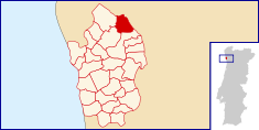 Location of Arcos in the municipality of Vila do Conde
| |
| Website: http://www.freguesiadearcos.pt/ | |
| Geographic detail from Instituto Geográfico Português (2010) | |
Arcos is a former civil parish in the municipality of Vila do Conde, Portugal. In 2013, the parish merged into Rio Mau e Arcos, a newer parish.[1] In 2011 the population was 819 [2] in an area of 5.81 km².[3] It is situated on the Ave River near the north-eastern frontier with the municipality of Barcelos, and resides in the shadow of its larger municipal neighbor.
History
The exact toponymy of this parish is not certain. It may have been named after a Casais Moorish castle with the same name, a Roman bridge near Monte da Reguenga, or a subterranean road that led to the Este River, where travelers stopped to water their horses.[4] It is very likely that a medieval castle existed in Argifonso, since multiple structures and a castro were discovered in the vicinity, but Moorish influences in the Iberian peninsula only occurred at the end of 711.[4] During Roman occupation, any settlements would have maintained cultivated fields, causing the abandonment of the castros. The Castro of Casais still presents vestiges of the Castro culture and Roman artifacts.[4] Legend refers to an ecclesiastical parish dedicated to Sant'Iago in Moldes, although no documented proof of this legend exists.[4]
The parish's landmark, the bridge spanning the Ave River, dates back to the 12th century, though historians suggest that an ancient bridge spanned the river prior to 1140. Medieval documents refer to this bridge as the via vecteris (old way), alluding to its Roman origin.
In 1836, Arcos was included as part of Vila do Conde.
There is a reference to São Miguel de Arcos in the ecclesiastical census in Braga and Guimarães during the 11th century (1078-1091).[4] However, neither records from the census administered by bishop D. Pedro, in the Sé Cathedral in Braga, nor the 1220 inventory of Afonso II of Portugal ever refer to Arcos as an ecclesiastical parish.[4]
Geography
|
|
Arcos is situated north of the Ave River and alongside the Este River in the north-eastern portion of Vila de Condo, near the municipality of Barcelos.
The Roman-style Ponte d'Ave (later Ponte de São Miguel) that crosses the Ave River north in the direction of Rates, and eventually to Santiago de Compostela.
Architecture
Civic
- Bridge of São Miguel (Portuguese: Ponte de São Miguel de Arcos) - Saint Michael's Bridge, along the regional EN306 roadway outside Arcos. The medieval bridge is of a cantilever construction of granite with three arches dating back to the 12th century. The voussoir (arching bricks) are straight, extra-hard but irregular, with the central arch the largest of the construction.
- Estate of Quinta de São Miguel de Arcos
Religious
- Chapel of Senhor dos Desamparados (Portuguese: Capela do Senhor dos Desemparados)
- Church of São Miguel (Portuguese: Igreja Paroquial de Arcos/Igreja de São Miguel)
Notable citizens
- José Maria Campos Trocado - responsible for contributing a memorial in the form of a cross to mark the parish's Christianity in the area of Rego. It was inaugurated in December 2009.
References
- Notes
- ↑ Diário da República. "Law nr. 11-A/2013, page 552 129-130" (pdf) (in Portuguese). Retrieved 8 July 2014.
- ↑ Instituto Nacional de Estatística
- ↑ Eurostat Archived September 6, 2014, at the Wayback Machine.
- 1 2 3 4 5 6 Manuel Fernando Soares Pinho (2005)
- Sources
- Pinho, Manuel Fernando Soares (December 2005). "Nos 150 anos da Igreja Paroquial de S. Miguel de Arcos – Vila do Conde" [In the 150 Years of the Parochial Church of São Miguel of Arcos: Vila do Conde] (in Portuguese). Arcos, Portugal: Fábrica da Igreja Paroquial de S. Miguel de Arcos.