Alipur, Bihar
| Alipur | |
|---|---|
| village | |
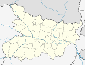 Alipur  Alipur Location in Bihar, India | |
| Coordinates: 24°56′N 84°50′E / 24.93°N 84.83°ECoordinates: 24°56′N 84°50′E / 24.93°N 84.83°E | |
| Country |
|
| State | Bihar |
| District | Gaya |
| Languages | |
| • Official | Maithili, Hindi |
| Time zone | IST (UTC+5:30) |
| Nearest city | Tekari |
| Climate | Humid Subtropical (Köppen) |
Alipur is a village in Gaya district, in the state of Bihar, in eastern India.
Overview
Alipur is a very prosperous model village located 9 km from the busy commercial town of Tikari in Gaya district in Bihar, India. Alipur Village covers an area of ---- km2, and has a population of 4,825 as of 2006. The Alipur village boundary of the Gaya district. The Village is bounded on the southeast by the Jhanabad District, on the south by Keshpa Village, on the west by Arwal,and on the northwest by Tikari Town.Alipur village has a marketplace. It also has a police station, which was established in 2001.
There is a well furnished Govt. school, located in this village. Govt. hospital facilities is available in this village.
Religion
Some places of historical importance in Alipur Village are Temples Alipur is home to a number of Hindu temples, including:
- Shiv Temple
- Thakurbari
- Devi Maa
- Sankat Mochan Hanuman Mandir
- Sun Temple
- Ram Janki Mandir (under construction)
Geography
Alipur is located at 24.93°N 84.83°E. It has an average elevation of 82 metres (269 feet). Alipur is 9 km from the city of Tekari, and is connected via a link road to the main road connecting Gaya to Jehanabad.
Demographics
The village is largely populated by members of the Bhumihar caste, who are mainly found in the Indian states of Bihar, Jharkhand, Uttar Pradesh, and the Bundelkhand region of Madhya Pradesh.