A110 road (England)
|
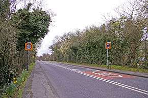
The A110 road running through Enfield. | |
| Major junctions | |
| East end: | Woodford |
|
| |
| West end: | Barnet |
| Location | |
| Primary destinations: | Enfield |
| Road network | |
The A110 is an A road in London, England. It runs from Woodford to Barnet, close to Underhill Stadium.
Route
Redbridge
The A110 starts at the junction with the A11 at Woodford Green. Only a short section of it is in this borough, and the road here is called Whitehall Road.
Waltham Forest
In Waltham Forest, the A110 is called Whitehall Road and King's Road before going through Chingford. It is then called King's Head Hill and then Lea Valley Road, running between the King George's Reservoir and the William Girling Reservoir, and crossing the River Lea. The road then enters Enfield.
Enfield
In Enfield, the A110 is called Lea Valley Road and Nag's Head Road at Ponders End. The remainder of the road towards Enfield town centre is called Southbury Road. The road serves Enfield town centre. Until the late 1980s, the road went along Alma Road and past Ponders End railway station; following the completion of the current A1055 road alongside the River Lea, the A110 was diverted to the north of the station. The original course is now called Wharf Road.
Further on, the A110 is called Windmill Hill before the junction with the A1005 at a roundabout, and then Slades Hill, Enfield Road and Bramley Road. After crossing the A111 road at a roundabout, the road becomes Cat Hill before leaving Enfield.
Barnet
The final section of the A110 is in Barnet. The road is called Cat Hill and Brookhill Road in East Barnet, and then East Barnet Road and Station Road until it meets the A1000 road east of Barnet town centre.
Landmarks on the route
- King George V Reservoir
- William Girling Reservoir
- Enfield Bus Garage
- Southbury railway station
- Enfield Town railway station
- Enfield Town Park
- Enfield Chase railway station
- Trent Park golf course
- Oakwood tube station
- New Barnet railway station
Coordinates: 51°39′08″N 0°04′28″W / 51.65222°N 0.07439°W
