Ørnes
| Ørnes | |
|---|---|
| Village | |
|
View of the village in winter | |
 Ørnes  Ørnes Location in Nordland | |
| Coordinates: 66°52′07″N 13°42′20″E / 66.86861°N 13.70556°ECoordinates: 66°52′07″N 13°42′20″E / 66.86861°N 13.70556°E | |
| Country | Norway |
| Region | Northern Norway |
| County | Nordland |
| District | Salten |
| Municipality | Meløy |
| Area[1] | |
| • Total | 1.51 km2 (0.58 sq mi) |
| Elevation[2] | 12 m (39 ft) |
| Population (2013)[1] | |
| • Total | 1,661 |
| • Density | 1,100/km2 (3,000/sq mi) |
| Time zone | CET (UTC+01:00) |
| • Summer (DST) | CEST (UTC+02:00) |
| Post Code | 8150 Ørnes |
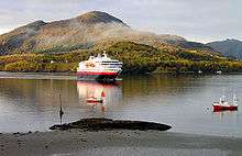
Ørnes is a village and the administrative centre of the municipality of Meløy in Nordland county, Norway. It is located along Norwegian County Road 17, about 6 kilometres (3.7 mi) south of Reipå and about 5 kilometres (3.1 mi) north of Eidbukta. The island of Mesøya lies just west of the village. Ørnes is a port of call along the Hurtigruten ferry route between Nesna and Bodø. The 1.51-square-kilometre (370-acre) village has a population (2013) of 1,661. The population density is 1,100 inhabitants per square kilometre (2,800/sq mi).[1]
The village can be traced back hundreds of years, but the year 1794 is recognized as the beginning of Ørnes, when Elling Pedersen was allowed to set up an inn at the place. Ørnes Church is located in the village, serving central Meløy. In this part of Northern Norway, temperatures can drop down quite low in the winter and the summers can be slightly mild. The lakes Lysvatnet and Markavatnet both lie to the northeast of the village.

References
| Wikivoyage has a travel guide for Ørnes. |
- 1 2 3 Statistisk sentralbyrå (1 January 2013). "Urban settlements. Population and area, by municipality.".
- ↑ "Ørnes" (in Norwegian). yr.no. Retrieved 2012-02-09.
